The 2022 Arctic Cowboys
Northwest Passage Kayak Expedition
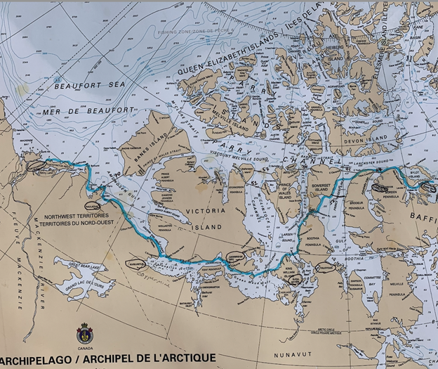
Our goal, since the idea came across my mind back in 2019, was to be the first team to kayak the entire 2000+ miles of the infamous Northwest Passage, which wound its way through the Canadian Arctic Archipelago, through a variety of routes, from Baffin Bay to the Beaufort Sea.
Several individuals and team have attempted the entire Passage and some even claimed to have completed the entire route; however, none had navigated the often-treacherous course without going overland, over frozen sea or from ocean to ocean. Mind you, these were monumental voyages and amazing accomplishments, though they fell short – by several hundred miles mostly, of attaining the defined eastern and western boundaries of the Passage.
To that point, the International Maritime Organization, international maritime law and the Canadian government defines the Northwest Passage as being bordered on the (see additional notes regarding the borders of the Northwest Passage). It’s common for the wind-reliant boating community to adhere to a definition of the Passage starting at the mouth of Baffin Bay, where it meets the North Sea and ending at the Bering Strait, in between the Beaufort Sea and the Pacific Ocean; however, to use those definitions, one has to strain the bounds of what defines an actual “passage” by Webster’s and the above-mentioned authorities. I’m willing to grant the sailor’s their lore, so long as they don’t try to inflict such mythology upon the rest of the water-faring community. If one isn’t actually going in-between two or more landforms, then you’re not actually in a “passage”.
To his credit, Roald Amundsen declared quite famously that he was the first to navigate the Northwest Passage via a water route, in 1905 once he cleared Cape Bathurst on the western boundary of the Passage, and entered the Beaufort Sea, where he met a group of whaling ships coming from the east. He was so enthused about declaring his accomplishment, that while his 5 remaining crewmen overwintered with the whaling fleet on the north coast of Alaska, Amundsen cross country skied over 500 miles to the nearest telegraph station in Alaska to get out the news, then skied back to join his team. It would be almost another year before he sailed through the Bering Strait. A word to the wise: don’t mess with Norwegians when it comes to winter and, from personal experience, do not get into a drinking match with them, either.
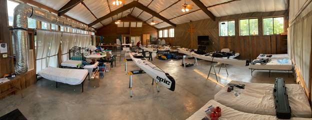
Figure 1 Prepping gear and kayaks at Pecan Park Retreat in Martindale, Texas
GETTING THERE
Our team of three, including myself, Rebekah Feaster and Jeff Wueste, drove from Austin, Texas to Ottawa in my truck loaded down with our three Epic 18x sea kayaks and all our gear. The customs officers at the Canadian border hesitated only for a moment when looking over my shotgun permit, until realizing we were going to the arctic, then strongly agreed it was a good idea to pack heat. As with most Canadians, the border personnel were professional and exceptionally pleasant.
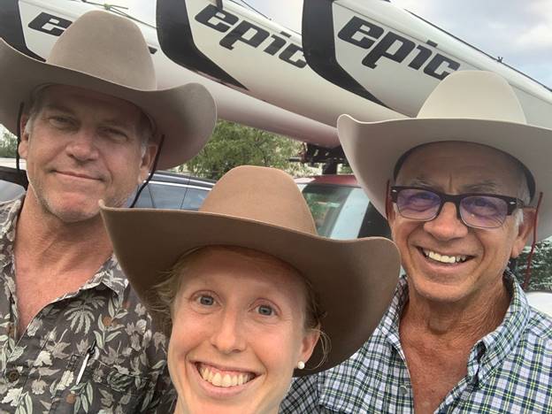
Figure 2 West, Rebekah and Jeff on the road.
Once ensconced in our hotel, conveniently located across the parking lot from the shipping dock at the airport, we got to work prepping the kayaks and gear for shipping to Pond Inlet, Nunavut. The duffels provided by The North Face made the gear packing easy and we wrapped the kayaks in cardboard and packing blankets. We got a rude awakening after depositing the kayaks at the shipping dock when we were charged 2.5 times the $1200/per kayak quote I was given by Canadian North Airlines as I was working up our budget earlier in the year. We got the agent on the phone with the manager at the loading dock and discovered that her computer program turned the 5.5-meter length I provided into 55 centimeters. She apologized once she discovered her mistake, but held to the higher price. Apologies were plentiful, but without any actions to back them up, they just lingered in the thick air. The loading dock staff were professional and pleasant, just like my proctologist, with a similar feeling for my part. Given the literal monopoly Canadian North Airlines has in the arctic, we had no recourse other than to pay up, which immediately overshot our budget before we dipped the first paddle into the ocean.
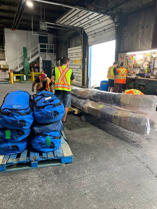
Figure 3 Wrapped and ready for shipping to Pond Inlet
Next, we learned that the kayaks and gear had no firm arrival date. From Ottawa to Iqaluit, the capital of Nunavut on Baffin Island, regular jet service handles shipping items on a daily basis; however, from Iqaluit to points north passenger service is handled by smaller prop planes. Jets still handle shipping larger items, like kayaks, but only when jet fuel is available in the smaller hamlets in the arctic. Jet fuel was scarce in the hamlet of Pond Inlet until a fuel barge could make its way up through the drift ice in Baffin Bay. At the time, there was not enough jet fuel in Pond Inlet, so there was no telling when our kayaks would get from Iqaluit to Pond Inlet. Additionally, when we tried to purchase passenger tickets from Ottawa to Pond Inlet the Canadian North website indicated that tickets weren’t available for another two weeks. Calling the airline on the phone was futile, with an automated message reporting that someone would call us back at some point in the undesignated future. We found this to be accurate in about 50% of the time and the call-backs occurred after 24-hours had passed. Finally, out of desperation, we drove over to the airport to purchase a ticket at the ticket counter. Old school and quaint, but as I mentioned, we were getting desperate.
Once at the airport, we found the ticket counters vacant. We later learned, in Iqaluit, Pond Inlet and Arctic Bay, the practice for Canadian North Airlines is to only have staff at their ticket counters immediately before planes were scheduled to land or take off, otherwise, like the telephone and on-line services, they were unstaffed. Without fail, everyone who lived or travelled regularly with whom we spoke in the Canadian arctic held Canadian North Airlines in strong contempt due to the regularity of the above-mentioned conditions and practices. Thankfully, Rebekah proved her worth by managing to book tickets through her phone which worked differently than trying to book tickets on a computer and three tickets were purchased for the team on the first available flight: one week away. We later learned that it was rare for Canadian North Airlines to take off with full flights, though no real reason was ever found. So, it wasn’t as if there were no seats available earlier than one week, just that none were available to purchase.
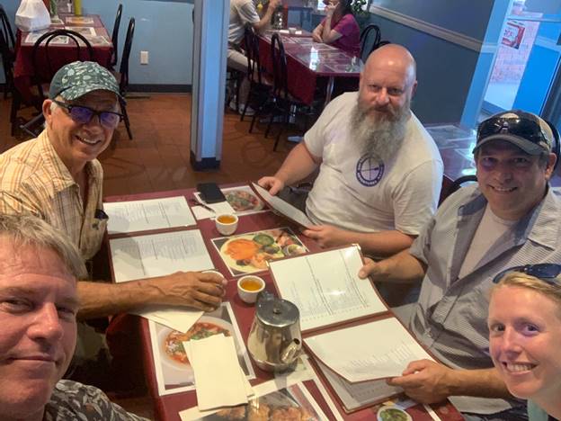
Figure 4 The AC team eating Korean with Sean and Derek, hosts of Paddling Adventures Radio podcast
So, we were stuck in Ottawa for a week, which we spent touring the city, meeting up with friends, watching movies and eating. It was really nice and almost every single person was really pleasant, save for Sandy.
The Resistol Hat Company provided the team with some really great cowboy hats. I wore mine pretty much every day on the water and off, to keep my head warm and keep the paddle splash out of my eyes and ears. It may seem strange to some that a cowboy hat would be good kayaking gear; however, many racers in Texas wear straw cowboy hats to keep off the sun and to protect ears/eyes from paddle splash. I loved and still love my hat, plus it helped us represent Texas well with everyone we met. Jeff’s hat was a bit too tight, so we found the only western wear store in Ottawa, confirmed it shaped hats and made out way over. Jeff asked Sandy to apply the steam and stretching tool to his hat, to make it fit better, but she refused. This is when it got a bit weird. She told Jeff to don his hat, then declared to him that his hat fit just right and this was how real cowboys actually wear their hats.
Now, I guess our Texas accents must be fairly muted, because she obviously figured we were from somewhere else. Jeff was born and raised in west Texas and had spent more than his fair share of time on horseback herding longhorns and other bovine in wide open spaces under a blazing Texas sun. Even without his bona vides as an actual cowboy, Sandy should have acquiesced to a customer’s request, but she stood firm and reported that if she stretched the hat, it would ruin it and it’d never fit him properly. Jeff explained that he couldn’t wear such a tight hat without getting a headache in five minutes. I further related that this wasn’t Jeff’s first cowboy hat and explained as politely as possible that we were from a place that actually wears cowboy hats as a necessary tool and not simply as an ornament. Things got a bit heated as Jeff tried using reason, but then with Sandy’s increased level of agitation at proving herself right he figured it’d be detrimental for his hat to be left with Sandy and we abandoned the store. Later, we read some online reviews of Sandy’s place and found this was a pattern. We found the one Canadian that wasn’t all that pleasant.
A few days after our kayaks and gear were shipped out, I got a wind-filled call out of the blue from someone who declared that our kayaks and duffels were on the gravel tarmac in Pond Inlet and I needed to come get them right away. This was going to be a tough chore from our hotel room in Ottawa; fortunately, our friend Titus in Pond Inlet was up for the task.
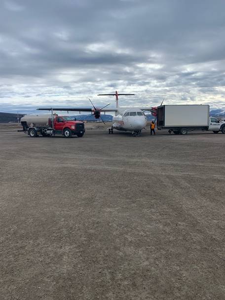
Figure 5 The workhorse of the Canadian North Airline fleet in Clyde River
Our plan was to land in Pond Inlet and be on the water after a day or two of packing gear, but this was not to be. Our stay in Ottawa should have taught us that nothing happens quickly when transporting ourselves and gear to the arctic and its best to plan on a lot of unplanned downtime. This is the greatest lesson I learned from our 2022 expedition.
Titus Allooloo is our friend. He’s one of those guys that not only has a really great sense of humor, but has a wealth of knowledge that should never be ignored or taken lightly. Our sources declared that the weather was great and we could launch immediately. Titus said just the opposite. Turns out we were looking at weather reports about the hamlet of Pond Inlet and Titus followed reports from the conditions that were actually out on the water. Wind and waves were torrential 10-miles offshore, right where we’d be kayaking, though the hamlet was quite pleasant. It’d be five days before we could depart, according to Titus. Another week of downtime.
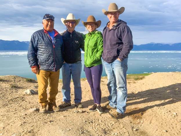
Figure 6 Titus and the team in Pond Inlet
We spent our time in Pond Inlet as guests of our new friend Diane, who needed a house sitter, which was really opportune since the only hotel charges $300/night per person. During the next week we met a caribou researcher, Chris Mutch, who cooked us a dinner of caribou and taught us the Canadian boardgame of crokinole, which is like the shuffle board we play in Texas dive bars, but without the barfights, honky-tonk angels and “Blue Eyes Crying in the Rain.” We also met almost every kid in town who asked us about life in Texas, tried on our cowboy hats and were a constant source of fun.
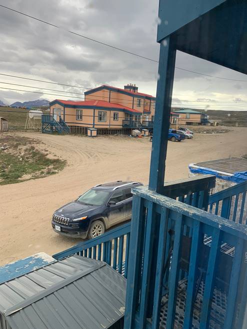
Figure 7 Pond Inlet neighborhood view from our porch
Our orientation with Parks Canada left us far wiser about working with a bureaucracy that has an actual permit, for which I had to pay, that granted me written permission to carry a “Locked and Unloaded Firearm” in polar bear country. To their credit, we also learned about the art of smearing feces over rocks in the outback so that it dries up and blows away in the wind and doesn’t harm the protected national park. This is referred to as “frosting”, which I have yet to attempt. I’m not sure if polar bears follow this same procedure, but I’ll ask the next one I encounter.
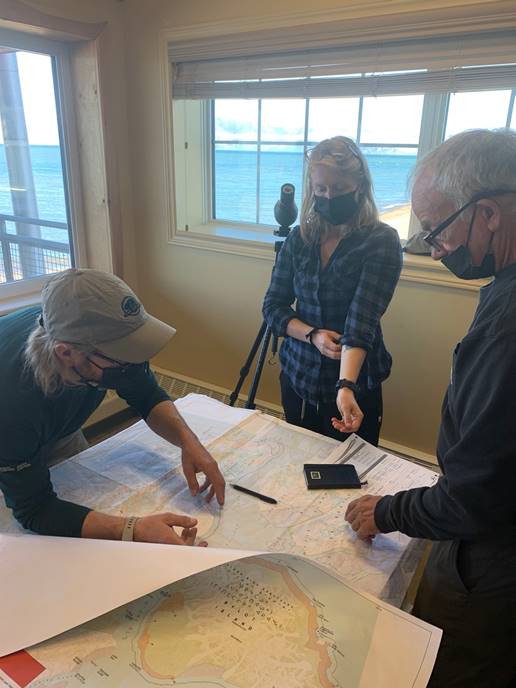
Figure 8 Meeting with Parks Canada in Pond Inlet
HEADING TO BAFFIN BAY
Once the winds calmed a bit after a few days, Titus set a departure time for 2 a.m. During the interim, he provided us with some choice pieces of arctic char, which is some of the best fish I’ve ever eaten. He also taught us about the water conditions, wind, waves and other extremely important aspects of arctic kayak travel. Along with all his other attributes, Titus is an experienced kayaker. While many Inuit appear stoic or low on expressions, by Texas’ flamboyant standards, Titus had a hilarious though dry delivery when bestowing humor or making fun of our Inuktitut phrasing. In return, we taught him proper Texan linguistics, which he adopted heartily.
After loading our three kayaks and gear onto his 29’ hardcore aluminum-hulled fishing boat, Titus and his friend, Steve, hauled us out from Pond Inlet to our launch location at Button Point on Bylot Island at Baffin Bay. The conditions at 2 a.m. were foggy but there was ample light to see our first polar bear scramble up a mountainside, then numerous glaciers and waterfalls along the mountainous northern coast of Baffin Island proper as we pounded along tall waves, east toward the ocean. Once the coast began to dip south, we headed north across the mouth of the Inlet to Bylot Island, navigating by Titus’ inherent knowledge of his backyard. Often, he and Steve would glance back at the coast, disappearing in the fog behind us, to maintain their bearings and heading, only to be adjust the angle of the boat to avoid the roughest of waves. Before long, we spotted our first ice berg in the mist, then eventually the southern coast of Bylot Island, which we handrailed to its southeastern most promontory, Button Point.
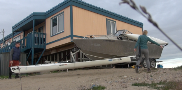
Figure 9 Jeff and Rebekah loading kayaks onto Titus’ boat for the trip to Baffin Bay start
Titus fed us some arctic char salad sandwiches after we unloaded all our boats and gear, then he and Steve headed back home at around 3 a.m., through the dusky fog. We waved goodbye until their wake and sound of his outboard motor disappeared into the mist. From there, we hauled all our gear up the 40-foot bank, onto the soft tundra, always with the shotgun at the ready and always on the lookout for polar bears. Once what seemed like way too much gear was up on the plateau, we began the trudge across the soft green ground cover to the two hunting cabins, which lay about 400 yards to the east, overlooking Baffin Bay.
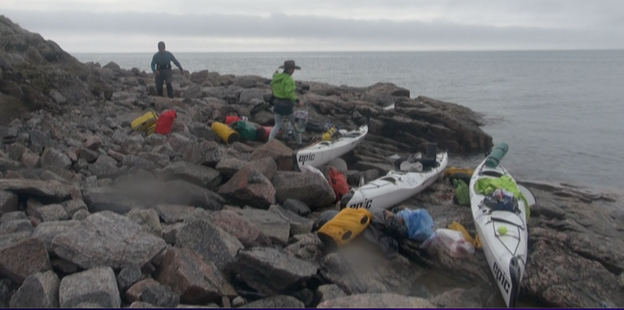
Figure 10 Loading kayaks at Button Point on Baffin Bay
We chose the lesser of the messy cabins, which smelled a tad less like kerosene than the other cabin. Rebekah considered both unfit for human habitation, while Jeff and I had slept in an amazingly less-appealing set of confines on the Amazon River and the Volga River, during previous expeditions. For us guys, it was quite nice and for Rebekah, it was just a slight upgrade from a thin slice of nylon tent-wall between us and a polar bear. After the gear haul, which included mainly our food and sleeping gear, to prevent attracting curious hungry polars bears, we settled in.
The lack of darkness played into our psyches at different levels. Jeff was unaffected in the least. He could sleep with a full mid-day Texas sun blasting in his face. Rebekah and I wore sleep masks over our eyes and added ear plugs to ward off the snores of our team mates – all of whom snored. Given that it was now almost 4 a.m., we didn’t set a wake-up alarm and just let the chips fall where they may.
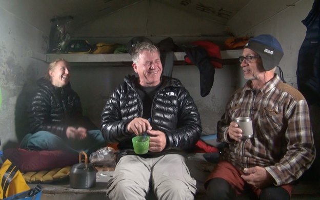
Figure 11 Breakfast at Button Point Cabin
We woke at almost noon, to the same amount of sunlight we had when we fell asleep, then reversed the trudge back to the kayaks to load the gear and set off in early afternoon in calm conditions and fog. I knew our sleep/day schedule was way off, in spite of the lack of darkness, so my expectations were fairly low for our first day. As well, the first couple of weeks of an expedition is rife with tweaks and adjustments as the team works into a set of patterns and habits. Once those systems are in place, then the real progress of an expedition takes place.
THE EXPEDITION LAUNCHES
Jeff was carrying a lot more weight in his kayak than the rest of us and tended to go a bit slower. Rebekah started feeling the first effects of sea sickness in the growing chop, as she struggled to slow her speed to match that of Jeff’s overloaded pace. Eventually, we called it an early day and beached in a convenient gravel cove after 13 or so miles. The level of cold ON the water was a bit of a surprise to me, compared to the level of cold on the land. Granted, we were in the arctic; however, the wise words of Titus came true: that everything is far colder at water level.
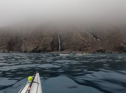
Figure 12 Jeff and Rebekah cruise by one of several waterfalls under low fog
It took us awhile to set up the flimsy electric bear fence, which Jeff and Rebekah thankfully commandeered. The setup included a couple of D-cell batteries and a life-wire set of three electric cords that surrounded the camp with four flimsy posts. It was difficult to keep each string taught, since the fiberglass poles flexed in the rocky ground. Furthermore, we had no idea at all if the contraption even worked! There was no red light or green light to indicate that was armed nor did anyone of us want to test it out. The idea was that a million-ton polar bear would wander across the electric cords and get shocked enough to decide we weren’t worth eating. We had our doubts.
After sat-phoning our expedition manager, my sister Barbara Edington, we settled in an fell asleep pretty quickly, but were soon startled awake when Rebekah declared there was a noise outside that was definitely NOT the waves hitting the shore. After pulling out my earplugs, we all agreed that something was breathing quite heavily just outside. Holy crap! I unzipped the two layers of tent and rain fly to find a herd of beluga whales cruising by, the grabbed my video camera to catch the tail end of the parade. It was a nice relief that the huffing was from a bunch of cute whales, rather than a million-ton omnivore in which whose back yard we were camping.
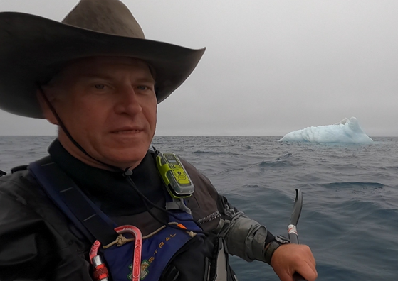
Figure 13 West kayaking by his first iceberg on Pond Inlet
We woke a few hours later to my beeping watch alarm and commenced the get-going ritual, which always takes about two-hours. This time took a bit longer, as we sorted gear to prevent Jeff from carrying an inordinate amount of weight. Today was the first day we were presented with the common opportunity to experience the process of elimination in full warm gear. Now, for the menfolk of our expedition, this was an arduous process which required working through and over a layer or two of neoprene and polypropylene underwear to access a member that was none-to-anxious to experience the frigid temps, thus did their best impression of a scared turtle. Still, with all those shrinkage-induced problems, the womenfolk on the expedition had a far more grueling challenge to overcome. So, with nature calling, we found a semi-wave-free cove to gunnel-up against some rocks for stability for the process. While there, we grabbed some protein drinks, water and snacks to calorie up for the remainder of the day.
The sun busted through a bit more than the previous foggy days, though a bit of overcast remained. While the winds from the east created a bit more chop, we still managed to make some decent progress along the mostly steep-cliff shoreline, which was dotted with magnificent waterfalls from the snowmelt and highland ice fields of Bylot Island. As the day wore on the waves grew in height and came from all sides, with the tide and wind directed waves countering the reverberating waves from the cliffs.
The glaciers on the south coast of Bylot Island no longer reach the sea, ending from a few hundred yards to several miles from the shore. What remains are strong white-water channels of glacier melt streams with water thousands of years old and clean tasting as any I’ve ever swallowed. These often-strong outflows hit the water of Pond Inlet to create a disturbance which can be accentuated by the sudden shallow depths, wind and subtle tidal currents.
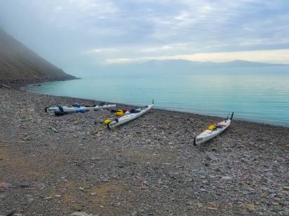
Figure 14 Kaparoqtalik Glacier Camp
When we approached the Narsarsuk Glacier from the east we met up with a house-sized iceberg grounded out about 100 yards from shore. Right there, where the iceberg was closest to shore, the stream from the glacier melt-off broke from the shore and tore into the turbulent shallows, coloring the brown water with aquamarine streamflow, straight out of the thawing glacier. The result was a mélange of waves coming down the stream, bouncing off the iceberg, combined with the influx from Baffin Bay and opposing wind driven waves from Eclipse Sound to the west. Your intrepid sea kayakers found themselves in a bounce-fest of steep four to six-footers with the attention span of a bunch of puppies on meth.
Right before hitting the most flagrant of chop, Rebekah got caught by a couple of errant taller than average waves and tumped over to her left, dipping over far enough to bare the bottom of her kayak to the sky. Fortunately, she braced enough to hold herself above water long enough to grab the bow of my kayak and right herself before any serious submersion. She rolled back up like a champ, then barreled headlong into the worst of it between the iceberg and the shoreline. Following the frigid maelstrom, we pulled ashore for a much-needed rest and decided to make camp for the day/night/whatever.
Turns out, this
was the only flat piece of property between the Narsarsuk Glacier and Kaparoqtulik. After dragging the kayaks ashore at the Narsarsuk Glacier and finding a flat space for the tent, we each hunkered down behind the largest boulders we could find to change into warm shore clothes. Optimistically, we laid out our paddling gear to dry in the stiff wind, only to find the humidity left us donning wet gear hours later when we put the gear back on. Still getting used to the bear fence, it took us awhile to set up camp and get settled. Eventually, once warm and dry we layered-up in the tent just in time for a large whale to get us scampering out with its call of howdy from its blowhole.
During our tent talk, Rebekah let on that she was wrestling with non-stop nausea, but only when we were out in out kayaks. It seems the constant chop was making her queasy. We all agreed to keep an eye on it to make sure she was taking in enough calories and fluids and determined to follow whatever pace she set.
Trying to get back on Texas time for our management team and followers back home, we set the alarm and got going in a respectable two hours at the start of the next “day”. The non-stop sun presence was becoming less of an issue, so long as we kept track of the time and wore sleep masks.
The next leg took
us along some really beautiful steep cliffs rising straight up for several hundred feet out of the water with little or no bank. Mist continued to hover, though the slight breeze cleared some of the low-level haze, allowing us to see fairly well for a couple of miles. The chop, while constant, wasn’t difficult to manage at about 1 – 2 feet with a general direction coming from our backs. After a mile or so, Rebekah slowed a bit and wasn’t her usual gregarious self. Jeff and I tracked her on both sides and carried the conversation, which for those who know us, isn’t much of a stretch. In this manner, we tooled along for a few more miles, each knowing something was amiss, but doing our best. Now and again, one of us would suggest a redirection towards what appeared to be smoother water, which was generally closer to the cliffs.
Seals popped up their curious heads to gawk at us and the occasional gull swooped down to be sure we knew this was their territory and to just keep moving if we knew what was good for us. The cloud cover was welcome, if only to maintain conditions that allowed us to keep our sunglasses in their cases. Now and again, some 200-foot cascade of pure ice melt water provided a postcard scene against the multi-colored cliff faces. There wasn’t a plant in sight and any sign of movement was relegated to the waterfalls, periodic rock slides and waves gently punching up against the cliffs.
After about six miles, we gained the gravel and rock chasm created by the retreating Kaparoqtulik glacier. Millions of tons of rocks, ranging from house-sized to marbles, were shoved hither and yon in centuries past by immeasurably huge ice dozers when the glacier was inching each year, propelled by gravity to the sea. Upon waning back up into itself and the mile-wide canyon it carved prehistorically, the glacier left in its wake a hodgepodge of rocky berms and piles, haphazardly stacked and loose enough to be shoved around on a regular basis by wind and rain. The only constant remaining effects of the glacier came from the torrent of melted ice that dug easily into the gravel base and which froze up again each winter.
As we came to the end of the cliff line, Rebekah spoke up, saying that she had to head to shore. Without question, we complied immediately and hoped to get there before she threw up. Jeff and I felt really bad for her and she must have been really miserable to have to pull over so soon. Perhaps she’d feel better if she vomited, but then we’d need to figure out how to get some calories in her not only for energy to paddle, but to fight off the incessant cold. I led the way to find a good landing spot while Jeff hung with Rebekah. Once on shore, we dragged the kayaks up a bit, then came up with a plan.
Rebekah’s nausea wasn’t going away anytime soon and by now we all knew that our lack of movement would lend us to get cold pretty quickly, so we set up the tent and changed into dry clothes to warm up. It was around this time that Jeff let us know that he left his life jacket (PFD) on the shore at our previous campsite. While paddling, he was admiring our PFD’s and comparing them to his, though he also admitted that his PFD felt quite comfortable and didn’t restrict any movement – mainly because it wasn’t on his body and rested back on the shore next to where he launched. Not only was a PFD an important part of our expedition, but on each of our PFD’s we had firmly attached an electronic device that, when activated, would send a satellite signal to all rescue authorities our location with a distress message requesting immediate rescue. These were similar to IPERB’s, but designed for wearing on PFD’s.
After raising the tent and getting warmed up a bit, Jeff borrowed my PFD and paddled his emptied kayak back to retrieve his PFD. It was a 12-mile round trip in calming water that would give Rebekah time to recover and for us to plan our next move. She settled into the tent, sipped water and napped while I explored the area. A group of tourists went to great pains to arrange small stones into the soft flat ground with their names and dates of their visit, which was about 15 years earlier. I guess we all make our marks on this planet in different ways. I gathered no information from their message other than their first names, last initials and date they were on the same beach. I can only hope any marks I leave behind have a bit more resonance and a bit more positive impact than Kilroy.
While he was gone, I emptied Rebekah’s kayak and moved the heaviest gear to my kayak and my light gear to hers, in hopes that a lighter load would get her speed back up, even if she wasn’t up to pushing all that hard through the nausea. She and I talked about ways she could get around the nausea, though I felt pretty useless, having never experienced such a thing on the water. Jeff returned with is errant PFD as Rebekah napped and busied himself making a small fire with driftwood in a well-used firepit. The area was obviously a popular camp spot, with rocks arranged for a private restroom near a cliffside, several recent tent rings and rocks set up for seating around fire rings.
We re-arranged gear and futilely laid out clothes out to dry in the occasional sunlight. Eventually, after several hours we gathered in the tent to discuss a plan. Rebekah still looked a bit under the weather, but figured moving the heavy gear from her boat was the best we could do and we all prepared to depart. Just as she started to put on her paddling gear, her nausea returned and she made the call.
It was a big blow to all of us, but mostly to Rebekah. She put so much into the expedition and to pull out within sight of the hamlet of Pond Inlet was incredibly heartbreaking. I made the sat call to Barbara, who contacted Titus via his friend, Steve, just before Titus was heading out for a week of hunting. Much sooner than expected – within an hour – Titus pulled up to our shore with Steve and another friend to take Rebekah, her kayak and gear to Pond Inlet. We really expected this to take much longer and ended up keeping some supplies we didn’t need and sending some supplies we later missed. On expeditions with multiple kayaks, the team gear is dispersed without any thought of us being separated, so the concept caught all of us off guard. With plenty of tears to go around, Rebekah climbed into Titus’ boat with her kayak lashed along the deck and motored away.
Jeff and I looked at each other and began to readjust back to the team dynamic we had on the Volga River expedition, when it was just the two of us. Rebekah’s presence was immediately missed. She was a great team mate and brought so much to our effort. It was really nice to hear new stories and to see our 30-years of stories from the perspective of fresh ears. Additionally, she was always quick to see what chore was needed and to take the lead on many aspects of the expedition. Though we hadn’t made much mileage and the light was going to be with us throughout the “night”, we retired to the tent that evening to reset our schedule and get a fresh start on Texas-time the next day. The four-person North Face Bastion-4 tent was now quite huge for the two of us.
ECLIPSE SOUND
Packing up our kayaks the next morning, we found things that should have been sent back with Rebekah and noticed things missing that we should have retained; however, with the quick response from Titus and resetting our team from three to two it’s understandable that we missed a thing or two. The laws of the irony are never too far from any expedition and ours was no exception. While the rough water conditions contributed to Rebekah’s decision, this morning we were met with glass-smooth water, clear skies and not enough breeze to wake a dandelion. Having been in this very situation with Jeff for a few thousand miles down the Amazon and Volga Rivers, there was hardly any call for talk as we methodically packed up and departed.
I was a bit warier of leaving some important piece of gear, given Jeff’s PFD situation and the fact that Rebekah was another set of very responsible eyes on which I had come to rely. For the remainder of our journey into the Passage, I could never shake the feeling, once we were out on the water, that we may have forgotten our tent poles – even after packing them myself a handful of times.
Passing through well-worn conversations and waxing poetic about Rebekah’s missing contribution to the team, we fell into the pattern of talking, trivia and stories that Jeff and I carved out over thousands and thousands of miles of kayaking alongside one another. Now and then I’d stop paddling in a fit of laughter or to emphasize an important point that could only be accomplished with a substantial hand gesture, only to receive that usual reprimand from Jeff, “Hey man, talk and paddle at the same time.”
We repeated for the hundredth time stories the other already knew by heart, that still got the same amount of laughter or incredulity they received during their initial presentation. It was a well-worn pair of boots in which we were tramping and the predictability was some comfort against the loss of Rebekah.
Shortly after launching, we cruised by the namesake of the National Park: Sirmilik Glacier and could barely make out the ice fields a mile or so back from the shore. We also were able to see the snow-capped peaks of Bylot Island much better as the steep cliffs gave way to flatter and flatter shorelines, dotted with occasional loose dirt hills and sandy beaches. Just after mid-day, a pleasant breeze gave us a nice boost from the east, propelling us nicely even when we stopped paddling for body maintenance.
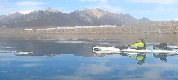
Figure 15 West kayaking by Sirmilik Glacier
Well rested, hydrated and fed we made good time as the sun poked out to give us a non-stop view of Eclipse Sound to the southwest. The sounds of gunfire and the occasional ricochet bullet off the water kept us in line as seal and whale hunters ran outboard boats back and forth across the Sound. The southwest corner of Bylot Island marked where Eclipse Sound turned north into Navy Board Inlet and with our progress, we spoke longingly about making this bend; our first significant landmark for progress. As Bylot Island flattened out more and more, we passed a handful of icebergs, glistening white and blue in the sun. Off in the distance, the icebergs were difficult to differentiate from the ore ships coming out of the Baffinland Mine, deep in Baffin Island.
The ships steamed at a slow 7 knots, recently restricted to the slow speed to keep from interrupting whale migration routes as much as possible for a bazillion ton oil-spewing ship. I held off contacting the ships on our VHF radio. While it would have been fun to gather information about where they were heading, I could think of nothing valuable they had to add that would justify hindering my forward progress by a few strokes. We found the paper navigation charts I insisted on bringing to be extremely accurate with regards to the water depth and land features. The shallows gave us the calmest waters, even when the tailwind kicked up chop in the deeper areas.
Bylot Island eventually merged from an Alpen mountain-scape to a flat west Texas desert as the piedmont sloped ever more gently to the western edges of Eclipse Sound and more shallow water. It was in this desert area, amongst what was now a pretty strong tailwind when we first noticed the diminishing number of ice-melt streams that dotted the shoreline so frequently at for the first three days of our trip. In fact, any streambeds we strained to look up appeared devoid of any waterflow. Having gotten quite spoiled by the omnipresence of clean, clear flowing drinking water, all of a sudden, we found ourselves thinking of how much water we had remaining in our dromedaries and, perhaps, taking smaller sips from our drinking bottles.
After hitting about 32 miles, we noted a thread of water trickling down a desert erosion, glinting in the sun. The wind was kicking up from our rear. Temperatures were dropping a bit, though the sun was still pretty high, given the 24-hour arctic sun; however, we were feeling the days end was quite eminent. Both of us wanted to keep going, but given the growing desert-like appearance and flat landscape, we felt inclined to grab what drinking water we could. The mouth of the stream created a convenient little estuary and low-land cove against the growing wind-driven waves. As soon as our bows hit the sand and mud, and we stopped paddling, the wind beat the cold against us and helped dropped our core temperature, though we wore out dry suits. In fact, I swear, the wind kicked up as we hauled our kayaks up the sand and we struggled to erect our tent.
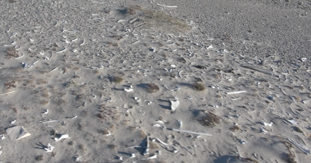
Figure 16 Bone beach near the southwest corner of Bylot Island
With cold, shivering limbs we nailed down the stakes and hauled up the tent, then we peeled off our dry suits and clambered into our warm bank clothes. This was our first sand-beach camp, reminiscent of a kayak expedition along the entire Texas coast during the height of COVID, in an attempt to treat our stir-craziness two years earlier. Right off the bat, drinking water was our first priority, so Jeff left me the flare gun and took off with the shotgun to scout our water source. While he was gone, I surveyed the beach to find hundreds of yards of skeletons and scattered bones of various forms of wildlife. I’m not sure if this was a hunting ground or if, for some reason, the dead bodies of marine mammals naturally washed up onshore, but regardless there were A LOT of bones on this beach. For over two-hundred yards I hiked over these bones, buried and partially buried in the sand. This area, on the southwest corner of Bylot Island, is an area restricted for a portion of the year because of wildlife migration.
Jeff returned with a report about a trickle of water, so the both of us hiked upstream a bit and filled our dromedaries for the next few days. We bedded down for the night, after our customary “tent talk” video, still adjusting to an expedition without our compadre.
NAVY BOARD INLET
The wind wailed throughout the “night”. Though out tent remained as solid as a rock, the buffeting from an occasional gust caused left me peeling off my eye mask and ear plugs to see if we were getting a polar bear visit. Thankfully, we were left alone and the sand around the tent had no tracks, other than our Crocs. Under heavy winds, we packed up our sandy gear in a bit more time than it would’ve taken in calm conditions – often chasing down a piece of gear worthy of air travel. Tides along Eclipse Sound aren’t particularly high; however, he did have to drag our kayaks through some muddy shallows about 40 yards before getting into water deep enough to accommodate our rudder, then eddied into the same windy conditions from which we departed the day before.
The transition from warm tent to warm-enough cockpit was always a cold one, but bearable. It was the more the grit from the sand in our rubber dry-suit gaskets that ate on us this time, leaving our wrists worn down and bloody by the day’s end. We looked forward to rounding Bylot Island into Navy Board Inlet this day and welcomed the tailwind, though the air temperature was noticeably colder, in spite of the bright sun. The higher wind speed made it more difficult for us to talk, so we paddled most of the morning in our own thoughts. Around mid-day, Jeff figured it’d be best to move some of his gear around in order to adjust the trim on his kayak, so we pulled over onto a gravel beach just after making the turn north.
Trim is the term we use to describe how a kayak sits in the water from bow (front) to stern (back). The kayak responds differently to a tailwind, sidewind, headwind, waves height and water depth depending on whether it sits in the water flat or if the bow is down or stern is down. Jeff’s boat was “weather vanning”, meaning the strong tailwind was trying to turn his kayak sideways. Though it’s fairly easy to correct the kayak using the rudder, a constant push on the rudder to maintain a course heading can cause more drag and slow down a kayak and in a really strong wind, render the rudder fairly useless.
I used the opportunity to grab a snack or two and rearrange some of my gear, then scout the area a bit. Inuit people have been here for hundreds of years and left tent-rings of rocks used to hold down the walls of seal skin tents during their travels and hunting trips. These well-used areas have transformed a bit, with some modern detritus alongside the ancient rings of rocks. This rest stop hosted the usual bones and some rusting metal fuel cans and barrels, with a piece of driftwood and drift-lumber here and there. Just as the cold was starting to creep in my non-moving bones, we shoved off and began making our way up Navy Board Inlet. With each stop, we used our satellite transponders to notify our team back home of our status, since we became quite the spectacle pinging our location out to the world every ten minutes.
Almost on cue, the wind took an abrupt shift and headed straight down south from Lancaster Sound through Navy Board Inlet, right into our faces. It wasn’t as strong as the tailwind we had in Eclipse Sound, but it was enough to slow our progress. To avoid the worst of the whitecap inducing breeze, we hugged the shoreline and trudge north. The gps on my deck indicated a drop in speed down to 2 – 3 mph, as we poked along. With the flattened terrain extending into the sea, handrailing became a bit more difficult since we had difficulty from a distance determining peninsulas that lay just a few inches above the water line, yet extended a mile out from shore. This led to some weaving in and out of channels and occasionally grounding out in some unexpected shallows, but all-in-all it was fairly easygoing.
The desert flats slowly turned into soft rolling green hillsides as we continued north. I hadn’t expected the greenery, what with the rocky terrain that dominated the mountainous areas between Button Point and Eclipse Sound. This was low-growing vegetation, but undeniably green and, dare I say, somewhat verdant for an arctic landscape. When the wind shifted from north to northeast, it picked up whatever rare scents eked out an existence in this beautiful but barren world. Without warning, while lost in the Zen of our methodic double-blading, I caught a full-nose whiff of something best described as green and sweet, but more subtle than honeysuckle, yet in the neighborhood. I hadn’t smelled anything but my own unbathed fragrance since departing Pond Inlet, nor had I really noticed the lack of any odors, but now I couldn’t get enough of it. Floating on the breeze was a quite distinct freshness that stood afront the cold breeze and stark landscapes. One of the three (perhaps four) things in life in which I spoil myself is good quality soap. Sure, by soap standards it may be expensive, but in the big picture a good smell in the shower at the end of the day is just one of those bonuses I find well worth it and the aroma escaping the rolling hills to our right was quite the little perk for me at the right time.
As we scooted along, talking and trading stories, we constantly calculated the near-future miles, wind, weather and other variables. During one of our many talks with Titus in Pond Inlet, Jeff learned of some graffiti from the 1850’s chiseled into a boulder at Canadian Point, which lay on the eastern coast of Navy Board Inlet as it made its big dog-leg curve. We wanted a photo of ourselves with this graffiti left by our forebears. I even had a set of yoga tights and jog bra picked out, so as to join the ranks of Instagram influencers. Perhaps I’d even only show my backside, while looking off into the distance and raising a heart-shaped hand signal. Anyway, the plan was to creep along the eastern seaboard, then make a 10-mile crossing at Canadian Point after hitting the historic graffiti. To accomplish this, we’d have to hit the Point at just the right time, before some super strong winds were to rush through the Inlet and create a lot of havoc during our big water crossing.
After doing the math, we decided on a fairly short day, then hit the alarm and get up early to make the timing work. So, after 20 or so miles, we found a narrow canyon that might have contained a stream (it didn’t), then made a shore hit. The breakers weren’t huge, but could still flood our cockpits, so we hit the shore, used the cord to pull up our rudders, then let the waves knock us sideways and drive us up on the gravel beach. Patience is a virtue with this type of landing, because if you sit patient as the hull rests against the gravel and just let each successive wave hit you, then the kayak will be heaved and rested up higher onto the shoreline further and further with each little hit. The first waves will be bigger, but the cockpit skirt prevents most of the water from flooding the cockpit and each wave gets progressively smaller until you’re resting on fairly dry land and have an easier time popping open the spray cover, scrambling out and turning the kayak perpendicular to the waves to prevent any flooding.
The tall hills and deep canyon provided a break against the westbound wind coming off Bylot Island. This meant the usual wind-biting temperature drop we usually felt when exiting the kayaks for the day was almost non-existent. After dragging the kayaks above the tidal mark, and hauling the gear up into a flat spot in the canyon we were actually quite toasty and stripped down to shorts and t-shirts, right there in the arctic. Not only was beachwear an appropriate part of our fashionable ensemble, but that subtly aromatic verdant ground cover proved to not only be fragrant, but soft on our bare feet. Though ground was soft and dry, neither one of us could break out of our Texas upbringing and unconsciously shuffled around to keep the non-existent fire ants from swarming up our legs and paid close attention to where we stepped in order to avoid stickers, thorns and cacti – the standard bearers for Texas groundcover.
Once we had the tent up and all things settled, we looked down upon the sundrenched Sound. The headwind died down and warm air created a Spring-like aura along the shore and leafy green hillsides. We should have kept paddling and considered doing so, but this would mean an hour or so repacking everything – by which time the conditions could take a turn for the worse. Given the pleasant weather and setting, I took the opportunity to hike up to the top of a bluff overlooking the next canyon and Sound to capture some video. As soon as I crested the hill, the blast of tornadic wind detonating out of the north damn near knocked me down and made me feel better about stopping so early in the day. It’s easy to make a call from the confines of a toasty, wind-free canyon, while the conditions on the water may be far different. After struggling a bit to plant the video tripod in the soft ground I made a quick report before the contraption blew over. I’ll certainly never be mistaken for Jimmy Chin.
Figure 17 First camp in Navy Board Inlet: warm, calm hills of soft clover!
Up and at ‘em the next day, the wind had calmed to a reasonable breeze and the temperature remained pleasant against a softly sunny sky. According to the report from Barbara, conditions were to be quite nice for the first few hours of the day before heavy winds out of the north kicked in again around mid-day. We had about 20+ miles before our crossing at Canadian Point. Along the circuitous route that bent from northerly to the west, we planned to pass a few glaciers at which we hoped to replenish our drinking water supply. The itinerary also included a stop to see the historic graffiti at the point where we intended to launch our crossing of Navy Board Inlet, the first crossing of our expedition. Doing some quick math, we figured this would have us making the 10-mile crossing right as the heavy winds bore down from Lancaster Sound.
At only an hour or so into our day, we marveled at the pristine conditions and glassy water when all of a sudden, we wondered why in hell we were waiting to cross. Just to get a look at the mid-1800’s carving? At that, we girded our loins, put our backs to Bylot Island and headed west across the Sound towards Borden Peninsula. The gps indicated it was about an 8-mile crossing and we could clearly see the snow-capped terrain on the opposing shore, with numerous streams and the same deep green hillsides. For me, there’s something a bit ominous about making open-water crossing, being away from the safety of the shoreline. I’ve made several large crossings on the Amazon and Volga Rivers (at night!) and along coasts of Texas and Vancouver Island. Some of these open water crossings were in some pretty serious weather and included waves up to 30 feet tall. What I’ve found, though it doesn’t lesson my apprehension, is that once out in the thick of it that I’m no more at risk of tumping over than I am while hand-railing the shoreline.
We monitored any sideward drift and adjusted our trajectory once we passed the halfway point. The problem with tall mountains is that they appear much closer than they really are, so they take longer to catch than I usually suppose. Still, the paddling was agreeable and water calm enough to stop for an occasional snack or pee-break. A bit of cloud cover rolled in as we gained the western shore of the sound and began to head north again. The hills were a darker green with snow patches, resembling what I’d picture to be an Irish coast, though I’d never seen an Irish coastline. Rocky outcroppings dotted the smooth landscape and shoreline. The skies darkened even more, though rain wasn’t all that common in the region and we had no cause for concern, since our crossing was completed. I prefer to kayak without my sunglasses, which an overcast sky allows.
Without a whole lot of warning, a polar bear surfaced out of the water about 100-yards ahead of us and scrambled up onto the rocks. Dripping water from its dark-white fur, the mid-sized omnivore shook off a bit, then glanced back at us. This holy-shit moment was expected pretty much every minute we were in the arctic, but nevertheless took us by surprise. I mean, a polar bear is not only the ultimate all-terrain hunting and killing machine, but it’s also a really beautiful animal, not that being eaten alive by an ugly animal would be any more horrible. Still, the sheer magnificence of this apex being at home was something wonderful that I’ll cherish forever. Apparently, the feelings weren’t all that mutual. Upon spotting me and Jeff, one of us scrambling for a camera, the polar bear wisely took off in a pretty quick pace along the shoreline. Now and then it glanced back to see if we were still in hot pursuit, though there’s no way we could have paddled as fast as it was running. Finally, it gave up the coast and headed up and over a hill to be rid of us. I missed the shot, of course, but we both agreed that this was really the best reaction we could ever hope for if and when we encountered a polar bear. Far from naïve, we paddled on, knowing that though we couldn’t see it, we were certain the bear knew our exact location.
With the darkening skies, the headwind picked up from the north at the exact same mid-day time that Barbara predicted for us and we were doubly glad we made the crossing earlier than scheduled. In the growing waves, we continued to make our way north, though eventually we had to tuck into the comfort of a cove to grab snacks and take care of business. Even though our stop was brief, it didn’t take long for the cold to penetrate deep into our bones, reminding us that yesterday’s warmth was an anomaly for the arctic. In the growing chop, we rounded the cove and skirted between the rocky shore and a massive iceberg about the size of a four-story building.
The pinnacles and outgrowths of the blue-white sculpture hung precariously in space, daring gravity and weather to disturb its display. Like a poisonous piece of jewelry, it was tempting to get close and touch the iceberg, but to do so was way over our pay grade. Ours was a mission rife with risk without the need to add any more danger. We appreciated nature’s splendor from a distance, which was just fine by each of us. As we rounded the point and came alongside the berg it morphed from a single mass of ice into three behemoths with sharp and rounded sides extending in all directions, with enormous biceps straining against the Earth’s pull fifty yards above the waves. Darkening skies accentuated the bright blue and deep white shades that mesmerized us to the point that we drifted backwards with the push of the wind, as we held our paddles still to take in the entire gallery.
From the north, Lancaster Sound unleashed stronger winds, which didn’t create any additional instability, but slowed our progress quite a bit. Our Epic 18x sea kayaks rolled over the waves without a bobble. Fog formed and drifted down from the grey ceiling and we could no longer see Bylot Island. Eventually, the gloomy blanket covered the mountaintops along which we paddled, and hovered just a few hundred yards above the water. White caps replaced the bumpy 3-footers as the wind matriculated into an eye-watering force. I tightened the stampede string on my cowboy hat and dipped the front brim so the wind pushed it down on my head, instead of ripping it off. More bothersome than the pokey pace, the wind and cloud cover dropped the ambient temperature to the point that our dry suits and light inner layers were no longer sufficient to hold in whatever heat our bodies generated and we began to shiver.
Landing spots were rare along this coastline, with rocky walls and promontories being the primary theme. Just as the sun pried open the heavens, just a smidgeon, we crept around Low Point. The terrain changed from an unwelcoming rocky blockade to a massive slope of rounded river rocks through which flowed several healthy white-water streams. Straining to spy the source, we could barely make out a snowy icy highland scene, rife with several waterfalls coursing over steep cliffs and meandering around boulders. The landings were still very steep, so we continued around the north side of Low Point, where we found an easily sloping gravel beach. The landing faced directly into the southbound wind, leaving us no choice but to land in the breakers, which thankfully were only one to two footers. Nosing in, we pulled up our rudders and let the waves pendulum us sideways and push our kayaks up the shore with each consecutive wave until we could safely scramble stiff-legged and stiff-bodied out of the tight keyhole cockpits.
After marking territory, always an immediate concern, we began the ritual that was still in the developing phase: erect the tent, don dry clothes, unload the kayaks, drag the kayaks up the shore, lay out the tent innards, find drinking water and so forth. With hypothermia always knocking at the door whenever we hit the shore, especially in high winds, we threaded the poles through the sleeves in our tent with shaking hands and nailed down the steel spikes, then reinforced it all with heavy rocks along the base of the rain fly. This camp spot accommodated far more household trash than anywhere else, most likely due to the direct course the wind and waves take from Lancaster Sound into the beach. Lancaster Sound comes in directly from Baffin Bay, which comes in directly from the Atlantic Ocean, which is a depository for everyone’s trash. Then, again this all could have been locally produced effluent. For me, there was no telling as the plastic bottles, pieces of plywood and lumber and other common detritus was mixed in with fishing rope and other nautical parts.
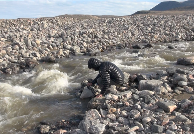
Figure 18 Jeff getting drinking water from glacier melt stream at Low Point.
I commandeered a slab of plywood on which to stand to change from wet gear into warm dry gear. The stiff breeze, though cold, dried me off in record time as I made the transition. We laid out the damp gear among the rocks with full knowledge that the humidity would prevent any drying out, regardless of the wind. Still, there was an ounce of hope that we wouldn’t have to squeeze into sopping wet paddling gear the next day.
Across the curve of Navy Board Inlet that went from west to north, the fog cleared to reveal a herd of icebergs near the far shore, then upon closer inspection through the binoculars, we spotted a trail of ice chunks sweeping in a long line directly towards us. The white lumps poked just above the surface in sizes that ranged from microwave oven to economy car and trailed in a line for a couple of miles. They weren’t crowded together in masse, rather followed in a loose line, through which I figured we could kayak, if need be the next day. Not that we could do much about it, but my biggest concern was that the ice hunks would amass against our beach, hindering an easy launch. As it was, a handful of iceberg-ettes bumped against our beach right now, but we put off the issue until the morning.
With shotgun always at hand, we strode over the stony moraines to the closest stream to refill our dromedaries, feeling quite water-rich for the next couple of days, then with winds buffeting the tent walls, I made the daily call to Barbara, we completed a tent-talk video, made a hot freeze-dried supper then hit the hay to the sound of waves crashing against the shore.
Nunatsiaq Point
Up at the beep of my watch alarm, we repeated the morning ritual: oatmeal, tea, coffee, bedrolls, habitat accoutrement all into designated containers and so forth, as we work our way out of our nylon chrysalis to face the elements. Once the tent is cleared out, with all the innards stowed in dry bags, we haul it all back down to the kayaks, then team up to break down the poles and shell that serve as the only home we know against the arctic. We each have undertaken specific tasks to compliment the construction and destruction of our home to assure it can stand against the weather and so that nothing is left behind, though I’m always second guessing that last part once we’re on the water each day.
Barbara and Tom worked up a condition report that promised 2 to 4-foot waves flanking us from the north as we made our way west along the shoreline, with winds up to 20 miles per hour. The upside was that after 6-miles, the winds were to subside down to a slight breeze and the waves would get themselves under control and drop down to one-footers. They also predicted the sun would emerge at some point around mid-day. Their prophecies were precise and we had out doubts, but there really wasn’t much we could do but keep on keeping on, so we dodged the accumulated ice chunks and launched into the headwind between berg-ettes and paddled into the fog. Following the shoreline for navigation as the fog grew thicker and thicker, we bounced along at a steady pace. The wind wasn’t hindering us much, being from our right; however, the tall erratic waves kept us from getting in strong digging strokes required for a faster pace.
Leaving our nice landing-beach behind, we gained the steep inhospitable cliffs again. With an eye always scanning for potential landing spots, in case of an emergency, I found occasional gravel beaches squeezed in between towering rock faces. Tall breakers would make for a rough crash landing; however, there was enough room to drag up our kayaks and deal with whatever crisis may have befallen us.
Along we bobbed, ticking off the minutes and miles in the vapor about 50 yards off shore, rounding small points and dipping into coves to avoid the tallest waves. Just as the winds began to abate, we dipped into a shallow cove under a fogbank that hung about 100 yards above our heads. The manageable waves reverbed against the cliffs as what appeared to be a white wall of granite came into focus. This struck us as quite odd, since the research we conducted on the arctic terrain never mentioned granite or marble, but here it was. Thick fog prevented me from getting a decent video or photo. Upon drifting a bit closure for inspection, we both realized simultaneously that we were staring at a wall of multi-colored ice that stretched up well beyond the fog into the sky. Holy shit. This was our first glacier to encounter that made it all the way to the water and we were in just the right place to be the next YouTube video tragedy. Town-sized parts of glaciers “calve” or break off without much notice and fall into the sea to become icebergs. Calving has increased tenfold around the world with the climate changing so rapidly, making the downstream side of glaciers some of the most dangerous places to be. With very little in the way of discussion, we turned our sterns to the massive ice fortress and headed out to sea.
Once at a safe distance, we took a left and followed the coast until, right on time, we hit the six-mile mark and the skies cleared, the windspeed dropped and the waves diminished to a civil height. Tom and Barbara were quickly finding their groove when it came with weather and wave conditions. We were pleased and impressed.
The western coast of Navy Board Inlet curved north as the mountains gave way to long easy beaches. The mountain ranges of the Borden Peninsula of Baffin Island retreated inland, though they still produced snow-melt streams on such a regular basis that drinking water no longer was a concern. Ice flows became common, but other than a few small flows with bowling ball down to tennis ball sized cubes, there really wasn’t much to them. Not and again we bump through a few or hit a large ice cube with our paddle. With the return of the sunlight, we warmed up nicely and could make out the snowcapped peaks and glaciers of Bylot Island across the Inlet in great
detail.
I kept my eye out for Tay Bay as we cruised at a good clip. Canadian Point seemed to take a long time to put over our shoulder, though the otherwise distinct corner was more difficult to make out from 14-miles away. Tay Bay, on Bylot Island, was the protected cove in which Alvah Simon overwintered in his 36-foot sailboat with his cat in 1994. He wrote a really great account of his experience in his book “North to the Night”. Initially, I thought it’d be really cool for our team to use Tay Bay as a camp spot, but logistically it just didn’t make sense. Still, I wanted to at least locate the bay during our expedition.
Given the high winds, fog and waves we endured for the previous 24 hours, it was really nice to have such amiable conditions for the remainder of the day and our mileage showed it. Out on the water, we passed a few icebergs, with a few hovering closer to shore. The sun glinting off the multicolored surfaces stood in contrast to the effects the darker skies of yesterday displayed the giants. The Inlet continued to get wider and wider as we headed north. It was good to have a horizon line to show our progress, where Navy Board Inlet merged into Lancaster Sound and the Parry Channel. The only land north of us was across Lancaster Sound at Devon Island.
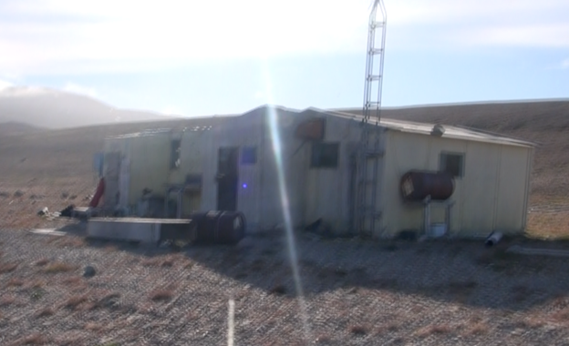
Figure 19 Nunatsiaq Point hunting cabin. (screenshot from rough video)
Well before we were too tired we came upon a set of hunting cabins at Nunatsiaq Point, across from Tay Bay. While we could have kept going, the cabins marked a place to get more drinking water. We probably had enough, but maintained an apprehension that leaned us towards a more conservative mindset. After all, we were on our own out there. The cabins also meant that we didn’t have to set up the tent or the persnickety electric bear fence (The fence was allegedly electric, not the bears.)
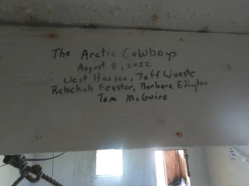
Figure 20 As is the tradition, we left our mark in the cabin.
With a comfortable landing in the semi-protected lee of the point, we scouted out the best cabin and hauled our gear up, then optimistically hung up our dry gear and settled in after once again filling our dromedaries in the local stream. This camp was well-used and strewn with the detritus of hunters: carcasses of long-dead snowmobiles, whales, seals, four-wheelers and their numerous parts, rusting in the sand. Decomposing fuel barrels were strewn about along with tools, camping/cooking gear and heaters. This particular set of cabins even held a smaller room with a five-gallon bucket, on top of which was a makeshift toilet lid, which was the closest thing to a luxury out here I could find. Some of the cabins were older and much smaller. All of the doors were a bit smaller than head-height. One cabin reeked of kerosene, causing me to wonder about the commonality of carbon-monoxide poisoning amongst these winter hunters. The largest cabins had a foyer, or mudroom, which provided an anteroom between the harsh weather and the living area.
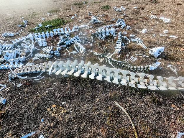
Figure 21 Whale and seal bones.
While the cabins weren’t warm, the plexiglass windows provided some night light, though this was a negative when trying to sleep. Thin time-worn cloth draperies did their best, but inevitably I’d rely upon my sleep mask. After supper and tent-talk, we spread out the large navigation maps and discuss our plans for the next day. My call to Barbara brought news about an impending windstorm from Baffin Bay down Lancaster Sound. Winds were predicted to be up to 50 mph with even higher gusts. We had a couple of days before the storm was to lay in, so we had time to ponder and plan.
Bluff Head
Under easy conditions we bid farewell to Nunatsiaq Point and debated about the terrain over at Bylot Island, across the Inlet as we paddled north. According to the map, Tay Bay was almost directly across, but at our distance it was difficult to make out the narrow entrance. I tried to reconcile the glacier and mountains adjacent to Tay Bay from Alvah Simon’s descriptions, but still wasn’t sure if I ever accurately located the bay. It was all just academic fuel for thought as our minds focused on the somewhat dire weather that lay ahead.
With a fairly benign headwind that veered a bit from the northeast, we paralleled miles of beaches before coming back to steep cliffs as we neared the mouth of Navy Board Inlet, where it meets Lancaster Sound. The more the day wore on the stronger the breeze grew and the taller the waves came in from the northeast. Fortunately, the wind topped out at a manageable speed, though the waves continued to grow. A pattern was established, with us moving into semi-protected coves, in between which we faced jagged promontories that jutted out into the ocean, creating turbulent conditions complete with huge waves crashing against the cliffs. We were always trying to find the least violent water, though it was debatable whether that was possible. It was obvious we needed to stay away from the boomers breaking nearer the cliffs and, of course the cliffs themselves. Reefs and sandbars complicated our efforts in choosing the best path, with each creating breakers and strong undertows. It was also a bit difficult to maintain a joint pace. We each varied our speed considerably depending upon the conditions and would often find ourselves a bit farther apart than I considered safe, if a rescue was needed, so I occasionally found myself redirecting in order to remain close enough to Jeff for my own comfort level.
A tump without a roll in such fierce conditions would be a difficult recovery or rescue. The ocean was bent on pushing us into the cliffs and an overturned kayak and floater would be at the mercy of the waves. Getting back into the cockpit and moving again in the subfreezing maelstrom would be a huge undertaking, even with help from an upright partner. Neither of us were adept at completing a roll, especially with loaded sea kayaks, but with one of us nearby an assisted roll was definitely the first thing we’d try. Overcast skies precluded the impending storm, though it wasn’t scheduled for at least another day or so. Pogies (neoprene mittens) weren’t necessary during the early part of the day, but now with the waves washing over our hands our fingers froze and transferred the cold to our core.
Rafting up to grab a bite and sip, we dug out our the pogies for some immediate relief, but didn’t linger for fear of catching an errant wave or having our core temperature drop for lack of movement. Additionally, every swell moved us closer to the cliffs and a constant vigil was needed to prevent being lulled into a dangerous situation. Now, the beaches within the coves no longer offered an easy landing, with three to five-foot breakers hitting the shore. While a landing was possible without being slammed up against the rocks, a watery tumble in the sandy shallows was a definite risk if a landing wasn’t hit perfectly. We paddled silently, with anticipation of the next cove offering some protection against the easterly wind and waves, but none was forthcoming.
Finally, we hit Lancaster Sound just as the fog descended to cover the tops of the cliffs. Rounding Bluff Head, the waves dialed it up to eleven, tossing us here and there with the additional reverb against the cliffsides from the full brunt of the forces emanating directly from Baffin Bay into the Passage. We could no longer count on any protection, albeit slight, from Bylot Island to the east. Right at the easternmost point of land I spied a set of modern looking buildings with some antennae equipment, though I couldn’t take my eyes off my immediate concerns for very long. Just to the north of the point, we were convinced that a landing wasn’t going to found, so we turned around and headed back to the cove just south of Bluff Head.
Orchestrating a 180 degree turn in high seas is a dicey and difficult maneuver, due in part to the kayak rudder being rendered fairly useless with the slowed speed of the turn. Add in some high-centering at the peak of some of the most virulent waves and you’re flirting with disaster. We took wider arcs than necessary in order to preserve our preferences for an upright attitude, then skirted just outside some nasty breakers at the south end of the point to re-enter the semi-protected cove. Once in the cove, it was like a day in the park compared to the erratic conditions at the point and we surfed into a fairly easy landing on the sand.
As was becoming the norm, we immediately started shivering once we stopped paddling and stood up on our unsteady atrophied legs. Together, we took turns team-working our heavily laden kayaks up the sand away from the growing surf, then scouted out a camp spot. We found the only spot available on a brief promontory that stood about 40-feet above the water at the end of the beach. Hauling the tent and gear up to the point warmed us up a bit, then we conducted the homesteading ritual before heading down to move our kayaks up the beach a bit more, since the waves were creeping even further, either due to the tide or the rising winds.
Figure 22 Looking south from Bluff Head, out tiny tent and kayaks off in the distance.
Once ensconced in our nylon cocoon, we set about pondering our plan for rounding the point into Lancaster Sound and navigating the northern shores of the Borden Peninsula. After pouring over the charts, I called Barbara who provided us with an ominous report: the winds will hit day after tomorrow at gale force levels and the waves will be over 12-feet tall. Additionally, we learned (and Tom verified) that the coast along the next 30 or so miles will be a string of cliffs without any possible landing; however, if we were to find a landing spot, then we’d be smack dab in the middle of a heavy polar bear denning area. Worst case scenario is being knocked over in sub-freezing water, slammed against the cliffs, then hauling what was left of our bodies up and over the climb only to be the Door Dash main course for a polar bear house party.
We’d told Barbara that we’d think about it over “night” and get back with her in the morning with our plan. We were finally making some distance in our 2000+ mile journey after so many delays and weren’t keen on having down-days so early on in the short season. From our perspective, we’d have to make the top of Borden Peninsula in one push before the storm hit. This leg would be without a stop, due to the cliffs and we definitely have to around ****York Point and into the lee of Admiralty Inlet and set up camp before the storm hit. Then, we’d have to batten down the hatches and wait several days just inside Admiralty Inlet for the storm to subside before we could safely make the 25-mile crossing over to Brodeur Peninsula.
We slept on it.
During breakfast the next morning, we discussed the upsides and downsides. No matter what course of action we took, there was no getting around the fact that we’d have to hunker down for several days during the storm. In that case, we surmised, it was best not be under the gun to outrace the storm along the top of Borden Peninsula, THEN be in a wind-battered tent for four days, not matter the confidence we had in our Everest-ready tent. To that end, we opted to check out what the official-looking buildings held for us at the top of Bluff Head. Perhaps they’d be manned by a Parks Canada official with plenty of heated rooms, showers and movies in which we’d be welcomed to ride out the storm. Even if we weren’t welcome OR if the outpost was locked up, we could pitch our tent in the lee of a building for extra protection from the storm, or gain access to an unlocked outbuilding. The buildings weren’t present on our navigation charts. Tom found a landing spot on the north side of the point, but couldn’t determine any further information about the buildings, which were on Inuit land – not Parks Canada controlled land.
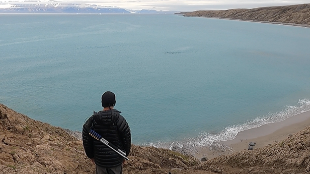
Figure 23 Jeff looking south from Bluff Head at a seal parade. Bylot Island in the background in a moment of calm before the storm.
Before hauling any gear or making any semi-permanent move, we grabbed the shotgun, flares and air horn and hiked up to the buildings to get the gist of the place. Perhaps we’d get a cup of hot chocolate out of the deal! Our hopes were high, though we also recognized that we may not be welcome.
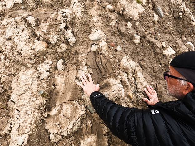
Figure 24 Jeff comparing his paw to a polar bear’s print… and coming up wanting.
After climbing the soft slope, we strolled across the dry-mud and gravel ground, passing a huge ring of rusted 55-gallon drums sitting about 100 yards in diameter. Most were on their sides, though some remained planted firmly in the ground with the base of some radio-type towers poking from their tops. The closer we drew to the dirty white buildings, the more we realized the site was abandoned, which was to our advantage, though it meant no hot chocolate or showers. The structures appeared a bit more solid than the hunting cabins we encountered, but were distinctly different with gable-style roofs with asphalt sheet roofing. Glass paned windows were all broken out and most of the doors were ripped from their hinges.
The entire complex consisted of four buildings: a larger main building that sat closest to the point overlooking the sea, a mechanics shed that held an ancient generator, a bunkhouse and a smaller bunkhouse/work station that held two old seismographs on a work table. Everything was built from plywood sheets sitting on pallets on the ground surface, so parts of the building dipped when the ground underneath gave way or eroded. Dirt blowing in through the broken-out windows covered everything and a layer of dried mud covered a good portion of the floors. The destruction wasn’t due to wind or animals. This was human vandalism, clear and simple.
Figure 25 Buff Head Research Station with the Quark Expeditions “Aquamarine” in the background.
Around the building were the offal of whatever research had been conducted decades earlier. Metal radio towers lay hither and yon, construction equipment, burn barrels and rusting snowmobile and four-wheeler frames (which seems to be theme), electrical equipment, lumber, spools of heavy cable, metal-working equipment and many, many large propane gas cylinders which must have contained the fuel used to heat the buildings and stoves. Whomever these researchers were, they certainly weren’t environmentalists or conservationists or they wouldn’t have left all this trash behind to rot in the dirt.
Figure 26 West/Jeff hauling kayaks up to Bluff Head research station.
We figured out that the middle building with only two windows was probably the best defense against the weather, so after spending three hours hauling up all our gear and kayaks, we worked to fortify the structure. First, using a decrepit broom, we swept off the plywood bunks, plywood tables and floor so we could set down our gear without covering it all in dirt. Then, we hunted down a handful of roofing nails and plywood to cover the window openings. I found a roll of felt paper in the pile of supplies behind the mechanics shed, with which we fixed between the plywood and the window opening to create a gasket against the wind and rain. This effectively sealed the building shut, but also produced a rather dismal, cold cave. I had the only headlamp, since Jeff saw no reason to bring one with the understanding that the arctic had 24-hours of sunlight. Darkness starts creeping back in around mid-August.
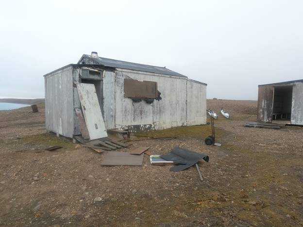
Figure 27 Our boarded up sleeping quarters at Bluff Head, “The Dungeon”.
I fixed the door leading from the mudroom to the main room, then wrestled a super heavy door from the bunkhouse to fashion as an exterior door against polar bears and the weather. This exterior door had the benefit of a plexiglass window which proved the only external light we’d get for the next few days. The heater was removed from this building, leaving a hole in the roof where the vent pipe used to poke, so Jeff climbed up on the roof and affixed a cookie sheet with several heavy rocks to keep in whatever warmth we could generate and keep out the wind and rain. To get up there, we had to move one of several sets of metal scaffolding still set up around the compound. By then it was raining, so we quickly hurried into the main building to get keep from being both cold and wet.
The main building had a leaky roof, but otherwise proved to be a good place to get a fire going. While Jeff hunted down untreated unpainted lumber to burn, I set up some scaffolding planks and a folding table up to block the two large windows facing the ocean. I left the two windows facing inland open, since they were leeward and we’d need some airflow to vent the smoke from our campfire. After setting up our bunks and laying out our maps and gear in our bunkhouse, we retired to the main building to build a fire with which to warm up. For obvious reasons we soon renamed this building “the smokehouse”.
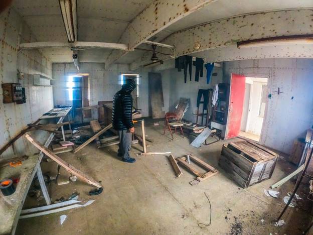
Figure 28 Jeff, the fire-master, at his craft in the smokehouse.
Jeff found an aluminum industrial sink amongst a pile of discarded building supplies, which when set on top of a rusted metal folding cot frame, made a usable fire pit. We dragged in more lumber pieces from the bunkhouse and wherever we could find dry timbers, then commenced to hack it all into kindling using our small hatchet. By supper time, we had a nice warm fire going, our wet paddling gear hanging from the rafters to dry in the smoke. Using our kettle directly in the fire, we boiled water from some herbal tea to help warm our innards.
Sufficiently worn out with all the hauling, hammering and prepping we hit the hay. My bunk had a lip on the plywood platform, which prevented me from sweeping off the layer of dirt, so I covered it with two pieces of felt paper (roofing “tar” paper) and a large piece of cloth previously used for curtains, I suppose. Jeff’s platform had no lip, so he was able to sweep it fairly clean. On top of our platforms, we place our inflated sleeping pads and crawled into our sleeping bags. It was a treat to sleep without the eye mask in the pitch-black bunker.
The Wait
By the middle of the next day, right on schedule, the winds picked up from the east, bringing along some sprinkles and mist. Barbara assured us that the worst was still to come with more wind and rain in the next few days. Before it all hit, we made our way down to refill our dromedaries and scout out the stream that led to the landing spot Tom reported on the north side of the point. A nice sand beach was semi-protected by the large rocky promontory that extended east and north from the point. A set of vehicle tracks indicated this must have been a well-used offloading point for boats servicing the research station, though I suspect most egress took place using a helicopter. Rough seas were common in this area and would make a beach landing pretty rough, even when using a zodiac. Just above the beach, on the clover covered slope, an overturned metal motorboat laid in wait for use. It was well above any storm or tide flow and didn’t hold the wear and tear of the buildings, so I suspected it belonged to a hunter or fisher who used Bluff Head for a base camp.
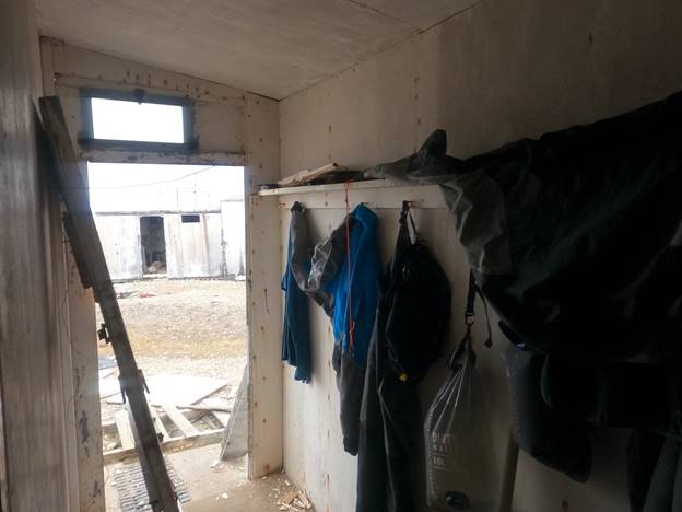
Figure 29 The foyer for our sleeping dungeon. The only thing between us, the storm and polar bears. During sleep, we propped up the door leaning against the wall and barricaded it shut with a pipe.
For the first time since our down time in Pond Inlet we had little or nothing to do but wait. Jeff took to the job of fire master, hacking kindling and making fire-stoking into an art form. Having trimmed our gear down to only the essentials, I purposefully omitted my favorite pastime from the gear list: a book. I’m an avid reader and was stuck with way too much downtime. We found a couple of 20-year old in-flight magazines, but that wasn’t going to do it. Finally, after scouring the area out of mere curiosity about this place, I found a few molded and rotting paperbacks in the mechanics shed. The least maligned tomes included one of my favorite classics of Americana, “Fear and Loathing on the 1972 Campaign Trail” by Hunter S. Thompson, which is as thick as a brick and I read it eons ago. The next in line was a 1960’s throwaway pulp fiction novel, “The Off-Islanders” by Nathanial Benchley, which I immediately recognized as the novel upon which the “zany” 1966 movie, “The Russians are Coming! The Russians are Coming!” was based. I never saw the movie, but remember the ads for it when I was a kid. It starred Carl Reiner, Brian Keith, Eva Marie Saint, Jonathan Winters and Alan Arkin, so perhaps I need to actually watch it someday. For now, I was elated to have something to read. The first 18 pages were missing and the moldy pages sat loose in the old binding, so I held it somewhat together with a piece of duct tape and handled it like a Gutenberg bible whenever I read it.
Figure 30 Straight from the Bluff Head literary collection.
With no paddling to do and our chores minimized to warmth and waiting for the next meal, Jeff and I rarely spoke. Now and again we pontificated about some issue or another, but for the most part sat in the comfortable silence that only a couple of guys can appreciate who have known one another through a couple of marriages, a few deaths, money problems, woman problems, a suicide or two, some near-death experiences on frozen and tropical rivers, oxygen-starved mountains, injuries, betrayals, drama and tender victories. We were both suffering for the lack of forward movement, but there were worse things in life.
We spent a good amount time trying to determine what research was conducted at this arctic outpost. Tom did a lot of digging back at our home-base, but couldn’t find anything either and I hope if any reader makes it through this narrative this far, who has any knowledge of the research station at Bluff Head on Navy Board Inlet, that they enlighten us. For all we knew, we were trespassing and committing some heinous office for some bureaucrat thousands of miles away, so we cleaned up and made repairs where we could with what little material we had, in hopes that we could help out whomever had to hunker down against the weather after we departed. Never leave a couple of carpenters with too much time on their hands, a hatchet and a fistful of rusty nails alone for too long. Given another week we would’ve added a few rooms and perhaps a sauna.
While on my meanderings around the grounds, I spotted a ship heading north up the Inlet. Once it anchored, about a mile offshore in the mouth of Navy Board Inlet, I contacted the captain via our VHF radio. This was the “Aquamarine” of the Quark Expeditions line. From what I gathered, this was a cruise ship business that brought intrepid explorers to the far reaches of the Arctic and Antarctic to experience things most people don’t, all in the comfort of well-appointed suites, a top-notch wine cellar, massages, hair-salon and mani-pedi’s. The captain was extremely cordial and acknowledged that he had heard of our expedition, then invited us over for cocktails. He was such a goddamned gentleman and professional that I felt the bones of my Texas roots crack just a bit under the weight of his grace. What with the effort it would take to haul the kayaks back down the cliffs to the sea, then paddle out to the ship and back, I politely declined, with a heavy heart. A civilized drink would have been quite nice, though my hands probably would have to pried from the leather chair and martini glass to throw me off the ship.
The ship remained for about five hours, or just long enough to disperse ten very large zodiacs full of well-heeled explorers with matching “Quark Expeditions” parkas to cruise along the shores we navigated in our kayaks and around the nearest icebergs. I stood atop the cliffs of Bluff Head as they cruised underneath, each of us taking videos and pics of the other. I suppose we were the oddity for them and they were the oddity for us. That was our only commonality, I surmised, since our night was to include a warm sleeping bag in a cold abandoned building and theirs included a steak dinner, hot tub, pillow mint and turn-down service. Explorers come in all shapes and sizes.
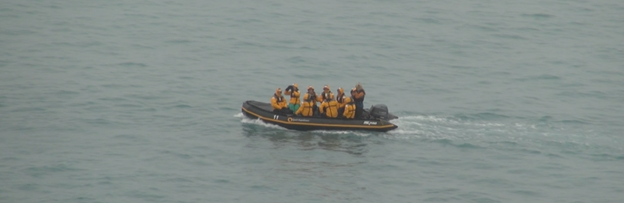
Figure 31 Quark Expedition “Aquamarine” explorers in their zodiac taking pictures of me taking pictures of them.
The captain let on that their next port of call was Arctic Bay, then Resolute before heading back to Norway (I think). We discussed the upcoming weather, which he confirmed, and bid each other fair sailing just before the cruise ship pulled up its anchor and moved off to the west into Lancaster Sound.
Jeff and I spent the best weather moments watching for whales and seals. The seals came in groups, which we referred to as parades and numbered in the hundreds. During our forays to fetch water, we spotted a total of three foxes – all of different wonderful colors. Polar bear footprints were plentiful, but thankfully none of them were fresh. Along the haul up the cliffs while bringing the kayaks, we crossed several prints the size of pie platters. To that end, we never went anywhere without the shotgun, flare gun and air horn. Way down below, we barely made out a pod of beluga whales cruising just below the surface. It was easy to spot them by the wake they created, but really difficult to actually lay eyes on them.
As the time for night descended on the second day, when the rest of the world was experiencing dusk, our overcast skies grew a bit darker as we finished supper and prepped for bed. This was the time predicted by Barbara and Tom, then corroborated by the captain of the Aquamarine, that the storm was to hit. We wired the bear-door shut, then propped a galvanized pipe against it to slow down any curious ursine, then we tied the interior door tight to double-down against the storm and settled in for the night.
Wound up tight in our sleeping bags we listened as the wind played havoc upon whatever loose materials hung off the structures and lay about the grounds. Under the dim light of my headlamp, I read about how drunkenness, sex and an insular existence created mayhem and entertainment when a Soviet submarine ran aground on a sandbar outside an island in New England during the cold war era. It was a pleasure to read how the author depicted women’s sexuality in that time, which isn’t much different than our time now, then remembered Natalie Wood in the movie “Sex and the Single Girl” of the same era with Jack Lemmon. I suppose the “sexual revolution” wasn’t with the advent of the birth control pill in the late 1960’s, but a bit earlier. The writing was classy, yet still era-driven enough to be appropriately cheesy or “zany”.
Eventually, the eighth bell sounded as I re-read the same paragraph three times through drooping eyelids, so I cut off the headlamp and went to sleep. I awoke a few hours later with something banging against the outside wall. Was it a polar bear? If so, she was fairly rhythmic, which was kind of cool, but irritating. We positioned the shotgun strategically, so that either one of us could grab it as we scrambled out of our respective bunks as the bear crashed through the door. Seriously, a lot of these things go through our minds in the arctic. The flare gun, hatchet and shotgun stood at the ready for battle, should a bloodthirsty polar bear ear through the two doors.
No one could sleep through such a racket so I knew Jeff was awake, like you know when your dorm-mate knows you’re awake as he has sex with a coed five feet away from you, so I pulled out my ear plugs and raised my eye mask to my forehead and announced, “Let’s go deal with this shit.” On cue, Jeff cussed to himself, not so quietly, as I heard him scramble out of his sleeping bag and into his clothes and crocs to face whatever battle we had before us. Untying the first door, then unwiring and moving the pipe barricade from the outer door, we stumbled headlong out into the midnight glare with shotgun and flare gun in hand, ready to beat to fucking death out of whatever woke us up. Wind gusts pushed us around, cutting through our haphazardly donned jackets to freeze our exposed skin as we carefully made our way around the structure to find a loose propane cylinder rolling back and forth against the wall. The ground was up a slight incline in the dirt to the wall. Wind gusts pushed it up the hill, slamming it into the wall, then the cylinder rolled back down in between gusts only to repeat the move at the next gust. We spun the steel tube sideways and went back inside, barring the doors along the way. Blessed with the talent of falling to sleep after waking in the middle of the night that many don’t possess, we were both sawing logs in no time.
The Polar Sun
The winds grew even greater in intensity the next day. White caps covered the ocean and huge waves blasted the cliffs below the research station, sending spray fifty or more feet into the air with each hit. We were spared a huge deluge of rain; however, we did get hammered for an hour or two in between long periods of drizzle. Temperatures plummeted just as our firewood dwindled. We sat on rusty metal folding chairs as close to the tiny flames as possible and used stiff Styrofoam insulation for seat pads to prevent the cold steel from freezing our butts. Though the wind never died down the windows I closed up in the main building prevented enough airflow to push out all the smoke. In fact, the effect of the buildings placement against the wind created an eddy-like condition that held the smoke in the building – thus making our refuge a smokehouse. We played with opening more spaces, but then risked losing what little warmth we could stoke from the small fire.
The only time we were actually warm was in our sleeping bags at “night”. For the most part, what we endured were just different levels of cold. Jeff was the primary wood chopper so I took on the task of scrounging more kindling from wherever I could. He rationed the rare wood to make it last two more days, when the storm was expected to abate, but now and then we conjured a decent flame and relished the warmth, albeit temporarily. Standing as close as we could, we rotated ourselves like pigs on a roasting spit. Frequently, we had to rush outside for fresh air when the smoke got to be too much and our lungs couldn’t take anymore. Every part of us and all our clothing stank of smoke long after we departed Bluff Head. Such was the price we paid for a few minutes of not freezing and a few seconds of actual warmth.
Using one of the plywood work tables built into a wall, I unfurled our pile of large navigation charts and we studied our upcoming route for the near future. Calculating our average speed and progress thus far, the expedition was going to take longer than expected, but we figured on speeding up once we dipped south into Prince Regent Inlet, on the west side of Brodeur Peninsula. Brodeur would provide a barrier between the wind and waves coming out of Baffin Bay to our east. It was these conditions that caused our current delay. Tom concurred with this assessment and worked with us on the plan. He and Barbara figured out that we could shorten the crossing from Borden Peninsula to Brodeur Peninsula, if we paddled a few miles into Admiralty Inlet to a place they named “Barbara’s Point” about 20-miles south. This would cut off about 10-miles and offer more protection from the higher winds and waves of the Parry Channel.
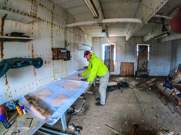
Figure 32 West reviewing the charts in the Bluff Point smokehouse.
Using this plan, we calculated the days ahead to reach our next crux move at Bellot Strait, which ran between Peel Sound to the west from Prince Regent Inlet on the east. Fort Ross is an iconic place where an old, but sturdy, Hudson Bay Company building sits and is visited by only a handful of travelers who have the opportunity to traverse the Northwest Passage. I laid out all our food on the table to take inventory. We had several weeks remaining, plus we had enough protein powder to make it to Cambridge Bay, where we had shipped a resupply. Prior to departing for the expedition, we made plans to meet someone at Fort Ross to get drone footage of us kayaking through the famous Bellot Strait, so there was a chance we could also get a resupply a little earlier than Cambridge Bay, if needed, but for now our main concern were the long open water crossings: 25-miles across Admiralty Inlet and 40-miles across Prince Regent Sound. Conditions had to be just right in order not to be caught in heavy winds and waves that were reported to be up to 12-feet high at times.
During this period, Barbara and Tom became quite expert with their wind/wave predictions and we relied upon their advice like gospel.
Around mid-day, while catching a brief glance out into the maelstrom, I spotted a small sailboat cruising north through Navy Board Inlet heading for Lancaster Sound. I reached the “Polar Sun” by VHF. The small boat sported only a tiny foresail, which was plenty in the stiff wind. They were on a National Geographic expedition through the Northwest Passage, having just departed Pond Inlet. I asked why they hadn’t sought refuge in Tay Bay and learned the drift ice prevented their planned stop there, so they just stuck to the water and kept moving. I got some video of them rounding two huge icebergs, then heading west in some pretty rough seas. They made it through the Passage a few weeks later after becoming temporarily ice bound just south of Bellot Strait and almost giving it up in Cambridge Bay for the season.
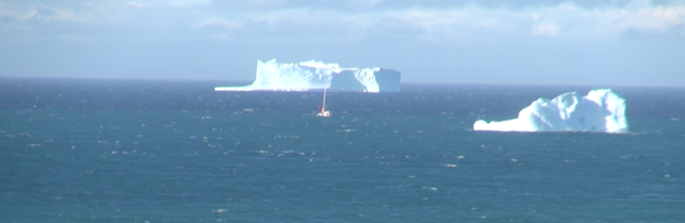
Figure 33 The “Polar Sun” negotiating icebergs in high winds around Bluff Head into Lancaster Sound.
Out of our Exile
By the end of the third day Barbara presented us with a revised forecast that indicated our window for departing had grown narrower. The winds were to abate somewhat on Sunday morning (it was Saturday now) and pick up again on Monday, so we had a day to get across the top of Borden Peninsula and into the protection of Admiralty Inlet and one more day for the 25-mile crossing before the conditions worsened. The firewood was all but exhausted and it felt good to busy ourselves in preparation for our launch scheduled for the next day.
We hauled our empty kayaks down to the overturned fishing boat above the beach, then made several trips to haul all our gear, save for what little we needed for our last “night” and morning at Bluff Head. The four days we spent at the research station felt far longer. It had been our concentrated world and I felt torn leaving it, but was also chomping at the bit to get on with our expedition. That last night I finished reading “The Off-Islanders”, which had a far more poignant ending than the silly events of the novel foretold. From here on out, I expected to be worn out and too busy to read as we carried on with the expedition, or at least this is what I hoped.
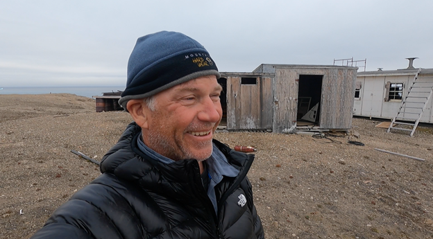
Figure 34 Last tour of Bluff Head research station. Happy to be on our way!
The next morning, we completed our usual rituals and after doing my best to secure the outer door, bid farewell to our Bluff Head refuge with hopes that it will provide a safe haven for other travelers. We launched around mid-day, when the wind and weather were at their most tranquil. The buildings remain solid enough for a substantial retreat, though they all need improvements, including plexiglass to replace the broken window panes. I would love to return with a pile of lumber, tools and gear to fix up the place. I’d begin by cleaning up the debris left by the researchers, then level each building and install metal roofing panels, then substantial doors and windows. The buildings are, simply put, ugly but functional. It wouldn’t take much effort to make them more attractive and more comfortable; however, getting the material to this faraway place would be costly. The stark location, void of any foliage, at the tip of the Borden Peninsula on the northernmost point of Baffin Island is bordered on three sides by the sea, offers a distinct beauty that many may not find all that attractive; however, once made livable, I’m the type of person that would relish living in such harsh, distant solitude to simply read and write for several months. Perhaps others of the same ilk would be happy to join up for a very unique writers retreat. If nothing else, it would be great fodder for an Agatha Christie murder mystery setting. We could screen “The Thing” and “Ice Station Zebra” during the orientation, just to set the mood.
Donning my paddling gear, I noticed that even though we had only kayaked for a week or so, I was already losing my gut. That’s the thing about our expeditions: we eat as much as we can and still lose a significant amount of weight. This is due to the inability to carry and ingest enough fat, combined with the slow fat-burn paddling day after day on end. It’s easy to pack carbs, sugar and protein, but fat is pretty heavy and bulky. I always look forward to this aspect of prolonged expedition, losing my gut – which has become a bit tougher to manage during my normal existence back home.
Our launches were uneventful in the small surf and the waves were fairly complacent until we made our way around the first point, when the chop grew to the spiky erratic personalities we had come to know before our arrival at Bluff Head. Once past that first point, we kayaked by a huge rock bridge carved out of the cliff side. I was tempted to paddle under it, but the tall swells and tight schedule to get around the peninsula dictated that we move on. A slight breeze and quartering waves from our rear moved us along well enough, though the overcast skies kept us from warming up much and warned of the foul weather in the coming days.
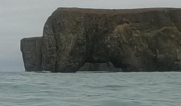
Figure 35 Archway at the northern tip of Baffin Island just west of Bluff Head on Lancaster Sound.
About 10-miles into our route the cliffs gave way to the occasional gravel beach which, though somewhat steep, offered up landing spots, should they be necessary. Even during the sections predominated by tall cliffs we passed short gravel beaches now and then. Jeff tended to drift away from the shore, while I preferred a route closer in where the shallows made for smaller chop and often smoother conditions, though the reverb from cliffs made close-in paddling much rougher than what we found a quarter mile out.
At mile 15 we spotted a few icebergs up ahead, stark white against the dark sky background. Now and again, when the haze lifted a bit and remnants of sun left us less cold, if only for a little while, we could see the mountains of Devon Island across the Parry Channel to the north. Now with the increased frequency of the beaches, I was much more relaxed but wanted to get into the protection of Admiralty Inlet and set up our crossing as soon as possible. By southern standards it was well into the evening by the time we hit the 20-mile mark. Jeff wanted to make a bee-line for the next point, which jutted out about a mile from the mainland, while I preferred to stay close to shore, so we compromised and hit a nice stretch of calm water.
The iceberg started taking shape as we neared, with two large columns defying gravity at either end, resembling somewhat a two masted schooner on the waves. The mountains retreated from the shore, leaving a solid beach for the last few miles, with several streams carving their way to the ocean. Up ahead, the dark overcast skies highlighted a set of breakers hitting the shore along the flat point, outside of which about 100-yards sat another iceberg, somewhat smaller than the schooner, but nonetheless imposing.
This section, along the northern point of Baffin Island, was one of the most beautiful sections we passed, to date. Smooth green and dirt hills rose out of the ocean for several miles, then gave way to tall, snow capped mountains. No wonder polar bears chose this place for one of their favorite denning spots. Given a thick coat of fur, I’d find the scenery quite stimulating and worthy of a honeymoon destination myself. We approached the point staying just outside the breakers. As the charts noted along this section, the shallows extended out a few hundred yards, but this wasn’t the cause of the breakers.
Just as we squeezed between the iceberg and the beach, we were met with a fairly large rushing river discharging into the sea, which when met with the shallows and incoming waves, causing the breakers. We easily skirted just outside of the worst of it, though this brought us within a few yards of the iceberg. By this time, I wasn’t so apprehensive, since it was a smaller berg and it was obviously lodged against the shallows. Such a large river would be noted on our map, and given the curving shoreline to the south, I guessed this to be the Charles Yorke River at Cape Charles Yorke, though we hit it a bit sooner than the 30-miles we predicted. I quick check of our gps confirmed our location as we headed south into Admiralty Inlet and crossed out of the western boundary of Sirmilik National Park and back into Inuit controlled territory.
Admiralty Inlet
Though darkness still eluded the season, dark clouds created an almost night-like atmosphere. It was close to midnight when we finally agreed upon a camp spot a few miles south of the Parry Channel. Gravel beaches and glassy conditions within the protected inlet tempted us to keep going, but we needed to rest up for the 25-mile crossing that lay ahead.
For a landing spot, we paddled a few yards up a small stream that spilled out from a shallow lagoon. The stream created a protected area away from the small breakers that hit the steep shoreline. Stepping out into the crystal-clear flow onto the gravel, my feet immediately froze in my neoprene booties. We scrambled up the slight embankment onto the loose gravel shore and set up our tent with shaky hands and chattering teeth. Eventually, we sat inside wearing warm dry clothes and settled in just as the rain started. We toasted our good timing, as setting up a camp in the rain was a miserable task and almost guaranteed that everything inside the tent would be damp.
After donning my sleep mask and laying back in my sleeping bag, I happened to notice a slight uptick in the noise coming from the breakers. While they weren’t huge by any standard, the slams were coming in more frequently and in a greater volume. I mentioned this to Jeff, then stuck my head outside to make sure we were camped high enough. Holy crap! The first thing I spotted was my kayak floating towards inland towards the large lagoon in a rush of water coming from the sea! We scrambled out into the drizzle and grabbled floating paddles and gear left by the kayaks, which were up on the shore next to the stream when we left them, but now were afloat and heading out.
The tide was coming in with a vengeance, reversing the flow of the stream and increasing its volume ten-fold. Not only were our kayaks in danger of deserting us, but the water was quickly rising up to our tent. We dragged the kayaks to the highest point about 40-yards away, then moved the tent and all our gear as quickly as possible to the same location. The detritus all around the high point indicated it hadn’t been flooded in a while, so we hoped we were safe. We watched in awe as the once tiny stream became a torrential tidal bore, increasing the size of the lagoon and gouging out the gravel stream bed.
Just as we were about to crawl back into the tent, we spotted a solid black fox about 50-yards away, standing calmly and watching the spectacle. It trotted around sniffing here and there, apparently unalarmed by our presence. While it never came much nearer, the little fox seemed quite unfazed by us and even a bit curious. Once settled again, we hit the hay with anticipation for the big open water crossing to come.
The Only Constant is Change
As with all expeditions, this one was no exception when it came to adjusting and making changes on the go. Upon waking late in the morning, we reviewed the charts and called Barbara for a wind, weather and wave update. The conditions were good to make the crossing; however, once we made it across the weather was going to turn pretty sour for the next few days and we’d need to hunker down again at the top of Brodeur Peninsula until the weather cleared. We had plenty of food for this push, but I was beginning to get concerned about our fuel supply. Without the gas for our camp stove, the dehydrated food would be difficult to eat, if not impossible. This was our main staple.
What I tried new on this expedition was a large titanium teapot, to accommodate three of us instead of the usual Jetboil pot that was sufficient for two. The teapot wasn’t part of the Jetboil brand and simply sat on top of the stove, instead of clicking in with the specially made baffles that helped water boil within a minute or two. The tea pot took almost ten minutes to boil water and over the past ten days used up a lot more fuel than I calculated we would require. Now that we were aware of the problem with the teapot, we no longer used it; however, the damage was done. With about one and half fuel containers remaining, we were going to cut it extremely close to making it to Cambridge Bay or Taloyoak or Gjoa Haven for more fuel.
Paddling each day, we would probably make it with the remaining fuel, but with the number of down days due to bad weather, it looked like we’d run out of fuel. Either way, this was a big risk than we weren’t too keen on taking. We were about to enter the area of the Northwest Passage that was farthest from any hamlet and covering some large crossings. To wait for the most optimal conditions to make the 40-mile crossing of Prince Regent Inlet, over to Somerset Island, may take a week or more, with each day burning more precious fuel for cooking.
We got Barbara to call our contact in Cambridge Bay to see if our fuel was available, then perhaps we could get the boat we were to meet at Fort Ross to bring us a re-supply. Not only was the pressurized fuel unavailable in Cambridge Bay, but it wasn’t to be found anywhere in the Passage. Having found the fuel readily available along the Amazon River, in Russia and almost everywhere I travelled, I made the mistake of assuming it was in the arctic, as well. I hung up with Barbara, then discussed the issue with Jeff. The arctic was no place to be taking chances. We already came to terms that this expedition was going to take far longer than the 60-days we predicted and we had the food, gear and determination for the long haul. All we lacked was the fuel.
So, with little else at our disposal, we planned to kayak 120-miles (there and back) out of our way to the town of Arctic Bay to get more fuel and a stove that would work with whatever fuel was available. Barbara found the fuel and the stove in the CO-OP store in Arctic Bay. This pleased Barbara and Tom, who were justifiably concerned about our open water crossing, due to the impending foul weather. Admiralty Inlet narrowed down to 15-miles at Arctic Bay, which would obviously make for an easier crossing, then we’d just kayak back north along the west side of the Inlet and proceed around Brodeur Peninsula into Prince Regent Inlet.
With a new plan in hand, we packed our kayaks and headed south in calm water, with a slight tailwind. After launching we drifted for a minute to adjust things and prep to paddle when we spotted the little black fox, who came out to watch us depart.
The land rose quickly to our left, with tall sandstone pinnacles and huge, boulder strewn canyons that replaced the rolling green hills. The steep cliffs mimicked the canyons and mountains of the US southwest, with red and tan dirt, rocks and sand. Cactus would have looked right at home, save for the sea water. Our maps proved extremely accurate, once again, making daily goals and camp spots somewhat predictable. We made the 5-mile crossing of Elwin Inlet without much fanfare, though the steep rocky mountains and deep crevasses offered up some stunning panoramas.
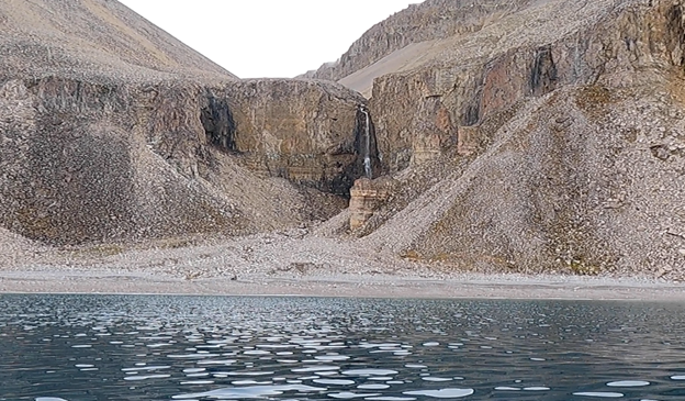
Figure 36 Gorgeous waterfalls were the norm on Admiralty Inlet.
After kayaking all day and through the rigors of setting up camp, you’d think that I’d be able to fall right to sleep; however, the pain in my hands often kept me up or woke me up during the “night”. Our hands go through a lot during an expedition with cuts and scrapes being the norm when grazing the rough inside surface of a kayak deck hatch or getting a nick from a sharp rock. The knives we carried from Templar Knives were razor sharp and any laziness in handling them was met with a quick, clean slice. Early on in the expedition, I haphazardly pulled my knife from its scabbard, running the blade right across my finger in the process. The cut was so precise that I didn’t feel it until Rebekah noticed the blood dripping all over everything. Over the next week or so, I kept the cut taped up, but each night once I wasn’t flexing my hands on a regular basis, like in normal use, they would swell up like sausages and re-open whatever nicks and cuts I gathered over the course of the trip. This was a bit painful what with all the throbbing and nothing could be done about it. Eventually, the swelling would subside by morning.
One morning, I awoke with an extremely swollen middle finger on my right hand. The top side of the finger next to the fingernail was deeply infected, probably from a nick I never noticed. The painful infection prevented me from bending my finger joint. After cleaning the area with an alcohol swab, I used a surgical needle to tear open a small hole in the bulbous dark purple infected area, then persuaded Jeff to squeeze out the puss. Using both hands, he inflicted an inordinate amount of pain upon my finger, but after several gallons of disgusting greenish goo, he finally got some blood to flow out. This was agonizing, but fruitful. I cleaned the wound, applied a liberal amount of disinfectant cream, then a waterproof bandage. The finger improved immediately.
This is a fairly common incident for us and we’re on constant vigil to maintain our bodies as well as our gear. Small things become really big things in a hurry if they’re not addresses. As for my swollen hands, I upped my water and electrolyte intake before bed, which helped a little bit.
After a day or two, steep cliffs became the norm once again, making our camp spots a bit scarce. We also learned that the boat designated to meet us at Fort Ross was damaged and stuck in Cambridge Bay awaiting repair. This caused a bit of concern, as we hoped to ask for the boat’s pilot to bring us additional fuel to Fort Ross, but we were still hopeful. With the knowledge that we were in it for the long-haul, we no longer stressed about timelines and would just keep moving the best we could. The boat would be repaired in due time and we’d meet up as planned, sooner or later along the Passage whenever our paths crossed.
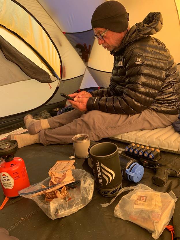
Figure 37 Jeff touching base with the outside world after breakfast. Note: shotgun always within reach.
With two days remaining to Arctic Bay, we found a narrow gorge in which to camp, just across from a fairly large iceberg. It was a bit frustrating to end the day earlier than we hoped, but we had no way of knowing if we could find another flat spot along the cliff-strewn shoreline before making another 5-mile crossing of an inlet, so we played it safe. Our team back home, among others, followed each paddle stroke via our satellite transponders and fretted whenever such decisions were made, “Why did they end the day so early? There’s a great camp spot just ten more mile down the shoreline!” From our perspective, we had no idea what lay down the shoreline and had to make decisions on the fly. It’s easy to navigate from the comfort of a desktop computer with accurate satellite images from thousands of miles away, but on the water, things look quite a bit different. We couldn’t take the chance to be calorie depleted, cold and without a safe landing spot if something went wrong, like a polar bear attack or flipping over from some other reason.
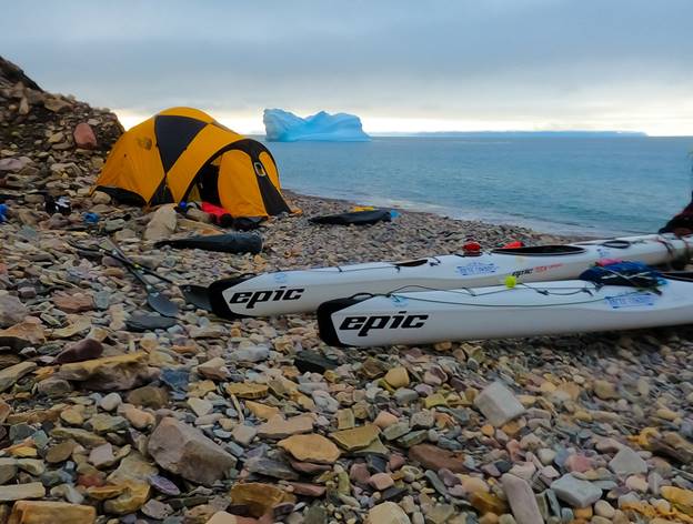
Figure 38 Iceberg Camp on Admiralty Inlet. Brodeur Peninsula in the background.
The next morning, we cruised easily by the iceberg, then had an easy crossing of Biergier Bay. Shortly thereafter, the cliffs gave way to long easy prairie and gravel beaches. This time, we could’ve covered the remaining 17-miles across Strathcona Sound and into Victor Bay near the town of Arctic Bay, but we didn’t want to arrive in the middle of the “night”, so we pulled up early and found a great camp spot just before a seal parade cruised by.
Barbara worked her Expedition Manager magic and found someone to not only pick us up in Victory Bay and haul us and out kayaks the five miles over to Arctic Bay, but to put us up for a few nights as we re-geared with a new stove and fuel before heading across Admiralty Inlet and onward through the Passage. Mark Lewandoski is the manager of Arctic Bay Adventures guide company. This super tall Canadian is a gentle giant of a man with a flair for cooking, it turns out.
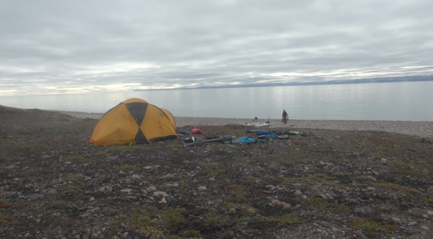
Figure 39 Final camp on Admiralty Inlet. Amazingly calm looking west across the Inlet to Brodeur Peninsula 20-miles away.
We covered the remaining distance by noon the next day, passing Strathcona Sound and the ruggedly beautiful and aptly named “Graveyard Point” leading into Victor Bay in calm conditions. The point isn’t named because of any bodies buried there, rather for the unique rocks that cover the green terrain, which look uncannily like tombstones. Kayaking in lake-like conditions with nary a breeze, we could see clear down to the sandy and rocky bottom of the inlet and wondered where all the fish were hiding. Barbara provided us with a lat/long where we would meet Mark, but this proved inaccurate and pointed us to the center of town, five miles from any potential landing. Plus, the coordinates were in decimals and our maps and gps were in degrees/minutes and seconds. Closing in on the end of the inlet, we found a good number of hunting and fishing cabins that resembled a makeshift town, or at least a suburb of sorts. Still, we weren’t sure where to meet Mark.
I texted Barbara with my InReach to ask for clearer directions or for a more accurate coordinate. She told me to turn right, then back left, then to go to 7 o’clock on an analog dial, then go around some rocks into a bay and so forth. It was a good learning moment for the team and we’d eventually determine a universal method for communicating navigation points. Given the delay in our transponder hits, her efforts to give real-time directions eventually got pretty hilarious. It was really funny kayaking in the arctic with directions akin to finding a donut shop. Finally, we figured it all out after we spotted a Ford F150 pick-up driving on the beach. Upon approaching, I yelled back and forth with Mark, who directed us into a cove where we could make an easier landing and load up.
Arctic Bay
Mark brought along his employees, Richard and Peter, to help haul us to town. We unloaded our gear into the back of the truck, then changed into dry gear before strapping the kayaks sideways across the bed of the truck for the trip into town. We figured Arctic Bay Adventures (ABA) was a kayak guide service with roof racks on the truck, but this had yet to be developed as part of their service. Still, the traffic was non-existent on the gravel road and the unorthodox loading method worked well. We were excited at the thought of catching a shower, sleeping in a bed and gearing up with a new stove and fuel. Barbara and Tom predicted heavy winds/waves for the next day or two, so we planned on a two-day layover before crossing Admiralty Inlet and heading back north.
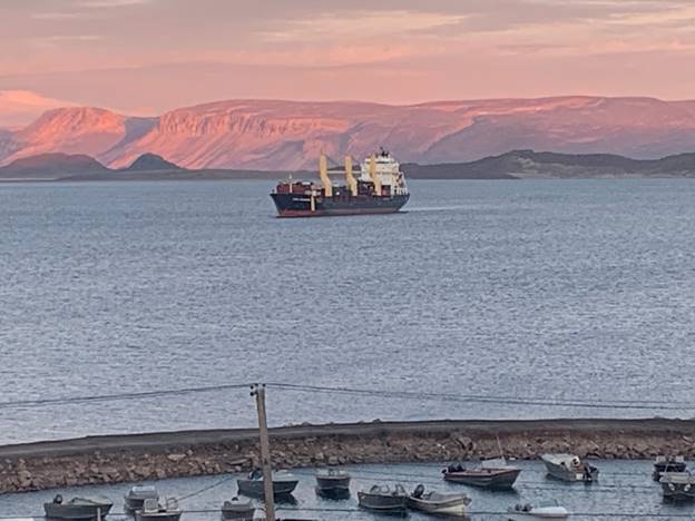
Figure 40 Once or twice a season, arctic hamlets get land-sea shipments.
After hanging out our gear to dry in ABA’s heated warehouse, we hit the CO-OP for lots of junk food, then were treated to the first of many great meals prepared by Mark. It’s always a very strange adjustment coming in from the wilderness and this was no different. After a really great night’s sleep in a blacked-out room with heat on a real mattress we set about planning our departure from Arctic Bay. Mark was on the ball, producing just the right stove we needed to burn whatever fuel existed. He donated the stove and told us where to purchase a tank of fuel in town and told us how long it would last us (plenty).
Next, we sorted/cleaned our gear and laid out our maps on the dining room table to review our next few weeks. Peter and Richard were locals and knew the terrain from information handed down from, not only their forefathers, but from actually being out there themselves. They showed us locations where we would find narwhal, seals and polar bears and the hunting cabins along the route. We discussed sea conditions and had a great time telling war stories.
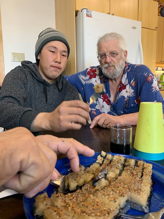
Figure 41 Peter and Mark in a rare moment when they aren’t smiling: muqtuq eating is serious business.
Mark had a huge supply of dehydrated camp food, if we needed more, which seemed to be the case. Jeff and I studied the maps and with a new respect for the amount of potential down-time we might encounter, carefully calculated the amount of food and fuel we’d need before a re-supply. After talking with Barbara and Tom, we figured the wind and wave conditions in Prince Regent Sound might require that we might have to wait up to two weeks for optimal conditions to make the 40-mile open water crossing. The crossing could last up to 15 or 16 hours, so it was imperative that we hold out for the best conditions. Tom not only monitored current conditions and the forecasts for the next few weeks, but the wind/wave conditions for the past few weeks in order to help calculate trends. He was pretty thorough.
Tom is one of these guys that if you give him and inch, he’d research it to death and devise an entirely new and more accurate system of measuring that inch to make it more accessible and easier for the common person to use an inch. Sometimes he makes the tragic mistake of trying to explain his processes to a common man like me and I’d have to cut him off before he scrambled my brain. During the expedition, Tom gained access to some incredibly accurate weather monitoring systems not normally available to the masses, from which he could pinpoint winds, waves and other components with some seriously Big Brother accuracy.
If we hit things at just the wrong time, we could find ourselves 20-miles from shore in 14-foot waves in 50 mph winds. As we experienced before, on this and other expeditions, we can handle huge waves and wind; however, making headway in those conditions is quite another topic. These conditions didn’t deter our expedition, but we had to account for the additional food/fuel for our potential wait time for the Prince Regent Inlet crossing. Additionally, the predictions for our navigation back up north in Admiralty Inlet and around the top of Brodeur Peninsula was rife with some heavy wind/waves, so we’d have some downtime just getting to our crossing point on the eastern shore of Prince Regent Inlet at Port Bowen.
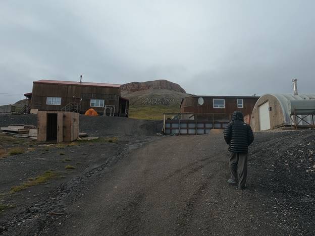
Figure 42 Our digs and storage warehouse (on right) in Arctic Bay.
Taking a very conservative approach, Jeff and I determined the amount of food/fuel we’d need to pack to make it to the supplies we shipped to Cambridge Bay, before the expedition. We hoped to avoid going south of King William Island by taking the shorter route directly across Victoria Strait to save distance and time, but this would mean we’d bypass the opportunity to resupply in Taloyoak or Gjoa Haven. Sea ice conditions in Victoria Strait were traditionally more clogged than the route around King William Island, but we figured we could make it through leads in the ice with our sea kayaks. Given a conservative estimate of time, we figured it’d take 6-weeks for us to kayak from Arctic Bay to Cambridge Bay, including the new estimates for down time.
There was no way we could pack enough food for six weeks between the two of us in our kayaks. Our tent, sleeping bags, warm weather gear and larger fuel containers took up a huge amount of room. Our protein powder supplement took up additional space, as did the kayak repair kit, first aid, bear fence, shotgun, battery rechargers, etc… At best, we could pack about a month’s worth of food, even with strapping a bunch of gear on the decks. The bottom line was that we would need to resupply before Cambridge Bay, even before Taloyoak or Gjoa Haven, which were shy of Cambridge Bay.
Our six-week estimate to Cambridge Bay, while conservative, still was a bit hopeful given the wind conditions. According to the residents with whom we consulted very closely, the winds this year were very abnormal. Rarely had they experienced such strong, sustained winds during their summers. These conditions kept them from their daily narwhal and seal hunts, with seas far too rough even for their motorboats and cabin cruisers. While pouring over our maps, which became a daily occurrence when local hunters came by, we were advised to adjust our timeline even longer to accommodate the chance that the winds would be far more prevalent than even the best models predicted. Everyone in the arctic watched the weather closely and monitored a full array of websites dedicated to arctic weather. This was serious business.
With that in mind and with the predictions from local Inuit hunters fresh on our ears, we got Barbara to arrange a food drop at Fort Ross, just shy of halfway to Cambridge Bay. Prior to the expedition, we arranged to have a support boat provide food/water for us during the final half of our expedition – roughly from Cambridge Bay to Tuktoyaktuk. The boat wasn’t going to shadow us necessarily, but meet us every few days with supplies and so forth. Barbara contacted the boat, which agreed to bring us 60 freeze dried meals from our stash in Cambridge Bay. This would give us enough food for extended down-days and take the pressure off us in case we couldn’t make it to Cambridge Bay before or food ran out. All told, with what we could carry AND the Fort Ross food drop, we’d have about 2-months to get to Cambridge Bay. This was well within our abilities and lowered the risk of rationing our food in these freezing conditions.
All that remained was for the re-supply boat to be repaired and we received good news on that front: the entire town rallied around the effort and declared they’d do everything in their power to get the boat on the water. We were feeling pretty good at this point, with a good food and fuel supply in Arctic Bay with a brand-new stove, a couple of days of rest and a solid plan to get resupplied with food at Fort Ross. With that, we set our sights on departing as soon as the weather was amenable. Given the wind issues and the boat repair timeline, we weren’t in a hurry, but were eager to get moving.
What a difference a day makes. The next day, we learned that the boat wasn’t able to be repaired to a level that would make it resilient enough to make the voyage and our resupply not only for Fort Ross, but for the second half of the expedition, was unavailable. Suffice it to say, this was a big letdown.
Our window of opportunity to complete the Passage was chipped away by the unexpected weeklong delay in Ottawa, then another week in Pond Inlet, then a slower than expected start once we were on the water, then four days at Bluff Head, then the diversion to Arctic Bay to get a new camp stove and fuel, then the additional down-days we predicted that lay ahead due to the unusual winds.
The food resupply at Fort Ross was the final straw onto which we were grasping for a successful Northwest Passage crossing. When planning the expedition, we calculated about 60-days to cover the 2000-miles from Baffin Bay to the Beaufort Sea, but as with most expeditions, things changed once we got underway. Doing our best, we adjusted to the increased amount of time for the expedition, but without a re-supply between Arctic Bay and Cambridge Bay the risks were too great to continue and we rescheduled the expedition for another year.
We simply had to live to fight another day.
Figure 43 Narwhal tastes like the richest steak you’ve ever eaten.
I enjoy a drink or two in my daily life, but don’t really think about adult beverages when I’m racing or on an expedition, but I sure could have used a stiff one the day we called the expedition; however, Arctic Bay, like many arctic communities was a dry town. Fortunately (or unfortunately), our host, Mark was an excellent cook, so I stuff myself to the gills for the next few days at this table to drowned my sorrows. Eventually, Jeff and I had to beg him to stop feeding us so much, as our waistlines regained their pre-expedition girth.
Ex Post Expedition
The next flight out of Arctic Bay, back to Ottawa, then on home to Texas, wasn’t for another week. Well, actually that’s not entirely accurate. Canadian North flew in and out of Arctic Bay almost daily, but in spite of each flight having empty seats, we weren’t able to secure tickets for another week. It was a bureaucratic headache trying to get ahold of anyone at Canadian North to sell us tickets. Eventually, we took what we could and nailed down two seats to Ottawa for about almost $3000.00 each, departing a week later.
Figure 44 Regardless of the language, this is merely a suggestion in Arctic Bay.
Mark arranged for us to stow our kayaks in the ABA warehouse. The tall shelves in the warehouse needed some reinforcement, so this gave us two carpenters something to do to help while away the hours. We also spent time walking around town, talking to residents and learning everything we could about the Northwest Passage from elders and hunters. It was an extremely valuable education as we began preparations for next year’s expedition.
Figure 45 More arctic cowboys.
We were joined at the house by three videographers who hired ABA to help them gather footage of local wildlife. Once again, I was desperate for reading material and was thrilled when one of the videographers shared with me a copy of a Stephen King novel. Otherwise, we spent time watching movies, eating, pouring over details for next year and napping. Mark drove us out to Nanisivik, the site of an old mining town where a naval refueling station was being constructed in Strathcona Sound. The modern buildings contrasted heavily against the mountains and unspoiled water of the setting. Apparently, the deep, protected cove was a perfect location for ships to pull alongside and dock for resupply while monitoring the arctic waters.
Figure 46 This dory was rowed by one of the first missionaries to Arctic Bay.
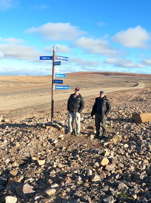
Figure 47 On the road from Arctic Bay to Nanisivik.
Our flight out was delayed 9-hours because the plane was delayed departing Resolute when the employees didn’t show up in time to prep the flight – then found a mechanical issue three hours after it was supposed to depart Resolute. The official word from Canadian North had to do with weather issues, but we learned differently from the passengers arriving from Resolute. During our 9-hour vigil in the tiny Arctic Bay airport terminal, we learned about the narwhal tusk trade and saw plywood boxed tusks being shipped out, with their final destinations in China where they’d be ground up and ingested by extremely wealthy men with erection problems. We were entertained by the Canadian North counter staff, who announced now and then that they’d have an announcement about our flight in 30-minutes. When the handful of passengers gathered to hear the announcement at the pre-designated time, we were told that there’d be another announce in an hour.
Each successive announcement simply contained the message that there’d be another announcement at another time. I asked the counter employee if this made sense to him and he didn’t seem to understand my question.
Finally, without any announcement, the plane landed and we learned what actually caused the delay from its passengers. We were all going to miss our connecting flight in Iqaluit, but were told by the Arctic Bay airline staff to talk to the staff about it when we landed in Iqaluit. Upon landing in Iqaluit, I was given a one-night hotel room voucher and a plane ticket for the next day. Jeff was given a two-night hotel room voucher and a plane ticket for the day after next. We tried to explain to them that we were traveling together and were told to call Canadian North airlines.
I called Canadian North Airlines right then and there. I got a recording stating that they’d return my call asap, which they did – four days later when I was back home in Texas.
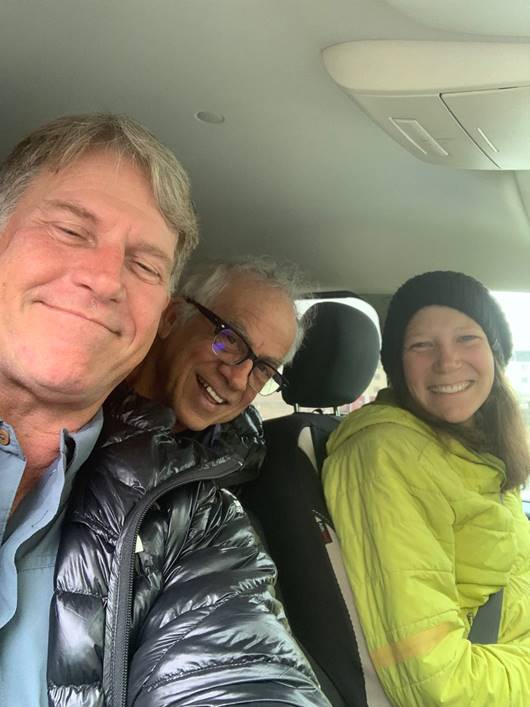
Figure 48 West, Jeff and Sarah in Iqaluit, getting a decent cup of coffee!
We met up with 31-year-old explorer Sarah McNair-Landry for coffee the next morning. She grew up in Iqaluit, the daughter, sister and wife of a bunch of heavily accomplished polar explorers and a badass in her own right. I’ve followed her expeditions for years and was thrilled to meet her. I had to depart later that day and Jeff joined Sarah, her mother and fellow explorer Max Lautenbacher for a wonderful dinner that could have gone all night and perhaps all week. Max kayaked several hundred miles in the arctic and was a wonderful source of information during our coffee. He related a time when he had to wait 21 days in a tent for the right conditions to cross the Parry Channel from the Brodeur Peninsula to the town of Resolute. It’s a lesson we’ve taken to heart.
Sarah mentioned that we just missed Borge Ousland by three hours. The renowned Norwegian explorer whom I loudly defended during the whole Antarctic Colin O’Brady farce was just returning from another arctic expedition and stopped by to visit Sarah and her mom, but had to catch his flight back to Ottawa and couldn’t stay. He was keen on hearing about the kayakers (us!) and our experience. Turns out the plane he had to catch was my plane to Ottawa. It was a packed flight and I had no idea he was on it. Jeff tried to text me, but my phone service, though an international plan, didn’t include any of the towns in the arctic. Had I known one of the super tall Norwegian guys on my flight was Ousland, I’d have ponied up to him for the flight and perhaps spent an evening with him in Ottawa. He was the subject of a memorable evening I spent in the lobby of the Explorers Club in Manhattan with a few of his countrymen over several bottles of scotch and I look forward to meeting him soon. We were born within a month of one another; however, his legendary expeditions are something I’ve admired for decades.
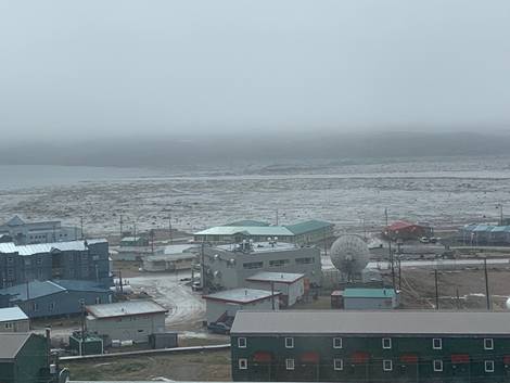
Figure 49 I believe Frobisher Bay at Iqaluit has the 2nd highest tide in the world.
Jeff and I met up back in Ottawa, had a steak dinner, then flew home to Texas. I caught COVID along the way and recovered quickly enough, thanks to the vaccines and boosters. Jeff was spared the infection and symptoms while I quarantined and reoriented.
2023 – Through a Land so Wild and Savage
So, here we are.
The principal focus keeping me precariously tethered to what remnants of sanity remain in my noggin is planning for a return to the arctic and a serious swipe at kayaking the entire Northwest Passage in a single season. We’ve nailed down one new team member and another is weighing his options. We’re a bit wiser after our 2022 foray and will plan on a lot more time without re-supply, on our own. The change from solo kayaks to tandem will increase our running speed and ability to carry more gear (see: food/fuel), plus the ability to handle bigger waves and more turbulent weather conditions. Our team will consist of four kayakers in two tandem kayaks, but we may actually end up with 5 kayakers, with one in a solo kayak.
Stay tuned and buckle up. It’s going to be an exciting ride.
Notes regarding the borders of the Northwest Passage
On the West. The Eastern limit of Beaufort Sea from Lands End through the Southwest coast of Prince Patrick Island to Griffiths Point, thence a line to Cape Prince Alfred, the Northwestern extreme of Banks Island, through its West coast to Cape Kellet, the Southwestern point, and thence a line to Cape Bathurst on the mainland (70°36′N 127°32′W).
On the Northwest. The Arctic Ocean between Lands End, Prince Patrick Island, and Cape Columbia, Ellesmere Island.
On the Northeast. The Coast of Ellesmere Island between C. Columbia and C. Sheridan the Northern limit of Baffin Bay.
On the East. The East Coast of Ellesmere Island between C. Sheridan and Cape Norton Shaw (76°29′N 78°30′W), thence across to Phillips Point (Coburg Island) through this Island to Marina Peninsula (75°55′N 79°10′W) and across to Cape Fitz Roy (Devon Island) down the East Coast to Cape Sherard (Cape Osborn) (74°35′N 80°30′W) and across to Cape Liverpool, Bylot Island (73°44′N 77°50′W); down the East coast of this island to Cape Graham Moore, its southeastern point, and thence across to Cape Macculloch (72°29′N 75°08′W) and down the East coast of Baffin Island to East Bluff, its Southeastern extremity, and thence the Eastern limit of Hudson Strait.
On the South. The mainland coast of Hudson Strait; the Northern limits of Hudson Bay; the mainland coast from Beach Point to Cape Bathurst.